Postcards from Pakistan
Postcard from Greece

Oia, Santorini
Early morning, the best light, before the crowds.
I have just returned from an amazing trip around Greece. We visited Athens, Santorini, Crete, Delos, Mykonos, Rhodes, Patmos, the Peloponnese Peninsula, and Thessaloniki.
I took thousands of photographs. From the thousands I have chosen just ten for this blog. These are my favourites for different reasons. I have provided a brief reason why I chose these ten under each image.
If you want to see more photos and follow our journey then find and follow me on Instagram @gaynor.shaw.photography

Pella, Thessaloniki
The detail of the pillar against abstract clouds.

Royal Tombs of Aigai, Vergina
What do you do when there are people obstructing a clear shot? Make them part of the image.

Mystras, Peloponnese
I love the detail and expression on the nun’s face. The black habit brings emphasis to the face.

Meteora, Thessaly
Emphasising scale - combining the detail of the monastery and the rocks all around.

Mykonos
Balancing light, colour and shape.

Monemvasia
Looking for interest in intersecting shapes and lines.

Mystras, Peloponnese
Small details can tell a story.

Thessaloniki
Architectural detail - light and repetition.

Patmos
Capturing drama.
Postcard from Japan - Kyoto
Highlights from my one day in Kyoto. I want to return and spend much longer in this fascinating city. But even with just one day you can see such a diverse range of places.

Fushimi Inari Shrine - I would like to go back and take my time to be able to find a new way of photographing this well known and well photographed shrine.

There are lots of smaller shrines along the walk. This particular shrine caught my attention as I loved the dark shadows and flickering candles.

Fushimi Inari Shrine. The Japanese and photographers love repetition.

Nijo Castle - exploring the details of the castle

Nijo Castle - so many textures in one shot

Nijo Castle gardens - shape, form and symmetry

Otagi Nenbutsu-Ji Temple - over a thousand individual statues hidden in the hills of Kyoto. An image to show the diverse faces.

Otagi Nenbutsu-Ji Temple - an image to show the detail of one face

Saga Toriimoto Preserved Street. A balance of vertical and horizontal lines, man-made and organic, with a scattering of autumn leaves for colour.

Saga Toriimoto Preserved Street - I loved both the detail on the roof and on the light
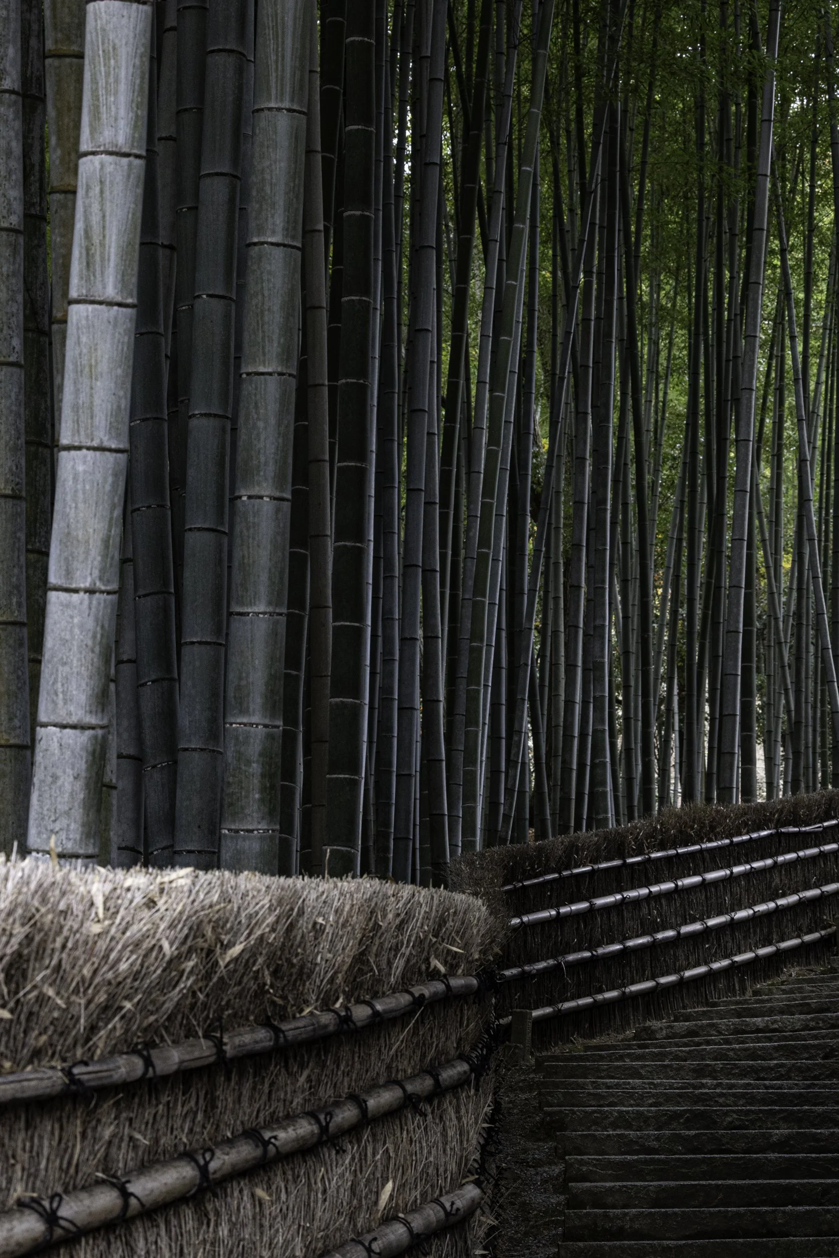
Bamboo forest - play of light on individual bamboo trunks, fencing and stairs

Kiyomizu-dera Temple - layers of interest

Kiyomizu-dera Temple - ancient and modern
Postcard from Japan - Mt Fuji

Mt Fuji has attracted millions of tourists, climbers, artists and poets. How could I capture such an iconic symbol of Japan in a new and interesting way?

For this image I waited for the canoes to move across the lake

I walked a little off to one side, away from the main tourist path. I liked seeing Mt Fuji with the almost bare trees and the city laid out beneath.

A visit to the UNESCO heritage listed village of Oshino. Mt Fuji in the distance, bare branches, reflections of visitors.

Sun setting over Oshino

My favourite image of Mt Fuji sitting at the end of a busy street
Postcard from Japan - Tokyo Highlights

I was lucky enough to visit friends living in Tokyo in December 2022. We visited so many different neighbourhoods in Tokyo, some traditional, some modern, all fascinating in their own way. I thought I would share some of my favourite photos from Tokyo and why I chose them.
The photo above is from the Hie Jinja Shrine. The Shrine is located on the top of a hill between the neighbourhoods of Akasaka and Nagatacho. To leave the shrine we walked out the back exit through the 90 bright red torii gates. The sun came out at just the right moment and lit the centre of the steps leading down. Sometimes you are just lucky to be in the right place at the right time.
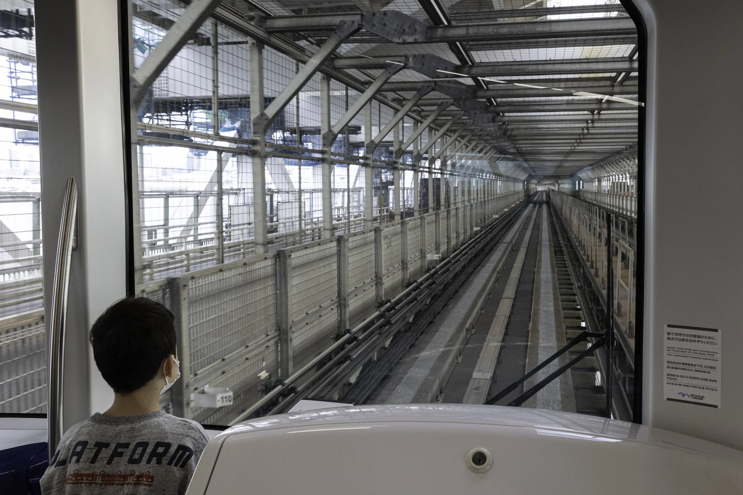
From the traditional to the ultra modern. I was on this train going out to Tokyo Bay. As you can see there is no driver. I love the leading lines and perspective. I had taken a number of photos but they had no real interest. It was when the young boy came and stood beside me that the image came to life.

Back street, Minato City. Wherever I travel I love taking photos of normal street scenes. I love the symmetry of this image as well as it’s raw quality.

Koi pond, New Otani Hotel. The garden at the New Otani Hotel with its bridges, Zen garden, ponds and waterfall is beautiful. I like that this looks like I have combined two images when it was a single capture. The position of the koi and the reflections of the almost bare trees gives a feeling of moving water and the cold of winter.

As I was leaving the Imperial Palace Gardens I took this image. I edited this image to change the tone and bring out a cinematic quality.

The next three, very different, images are all about capturing landscape and people. This photo was taken at Senso-ji Temple, Tokyo. I wanted to capture the scale of the temple (vast) and the number of visitors (large).

The famous Shibuya crossing. I took many long exposure photos waiting for one where someone stood still while all around people are moving.

teamLab Planets, Tokyo. This immersive art installation is amazing. Truly immersive as at times you walk through water, through flowers and are surrounded by images and lights. When the two men stopped in the pools of light I thought it would make a good image combining repetition and reflection.

Paper wishes or fortunes called O-mikuji. These wishes are tied to trees or a fence to ‘tie your wish to the life force of the tree’ hoping it will make your wish come true. I love capturing small, important details.

Tokyo Skytree. The Skytree captured from a different angle that emphasises the construction and shape of the viewing platform.
Postcard from Australia - Three Capes Walk Tasmania - Day Four

April 2024 - our last day on the Three Capes walk - 14km. We are walking with a full pack and the day begins with lots and lots of stairs. It is a steep walk up Mt Fortescue. I don’t mind the climb as the scenery is stunning: lush rainforest: moss covered trees; fungi and ferns. We continued the walk to Cape Hauy. You can leave your pack at the top of the loop out to the cape and just take a day pack. We start down the steep stone stairs as it begins to rain. We didn’t make it all the way out to the end of the cape as heavy rain set in. The rain lifted as we walked into Fortescue Bay. A bus takes you back to Port Arthur. We get home, we eat non-hydrated food and have a hot shower. We enjoy the home comforts but we are already missing the beauty of the Three Capes.


Postcard from Australia - Three Capes Walk Tasmania - Day Three

Day three, Three Capes Walk, Tasmania, April 2023. Today is the longest walk, 19km, however for three quarters of the walk we only have to carry our day packs. It is a relief to leave our big packs behind, except when we have to pick up the 15kg pack for the last 5km. The guide says today is all about drama and adrenalin. The walk out to The Blade and Cape Pillar is spectacular and there is plenty of drama as you look across to Tasman Island and watch the rain sweep across the bay.


Postcard from Australia - Three Capes Walk Tasmania - Day Two

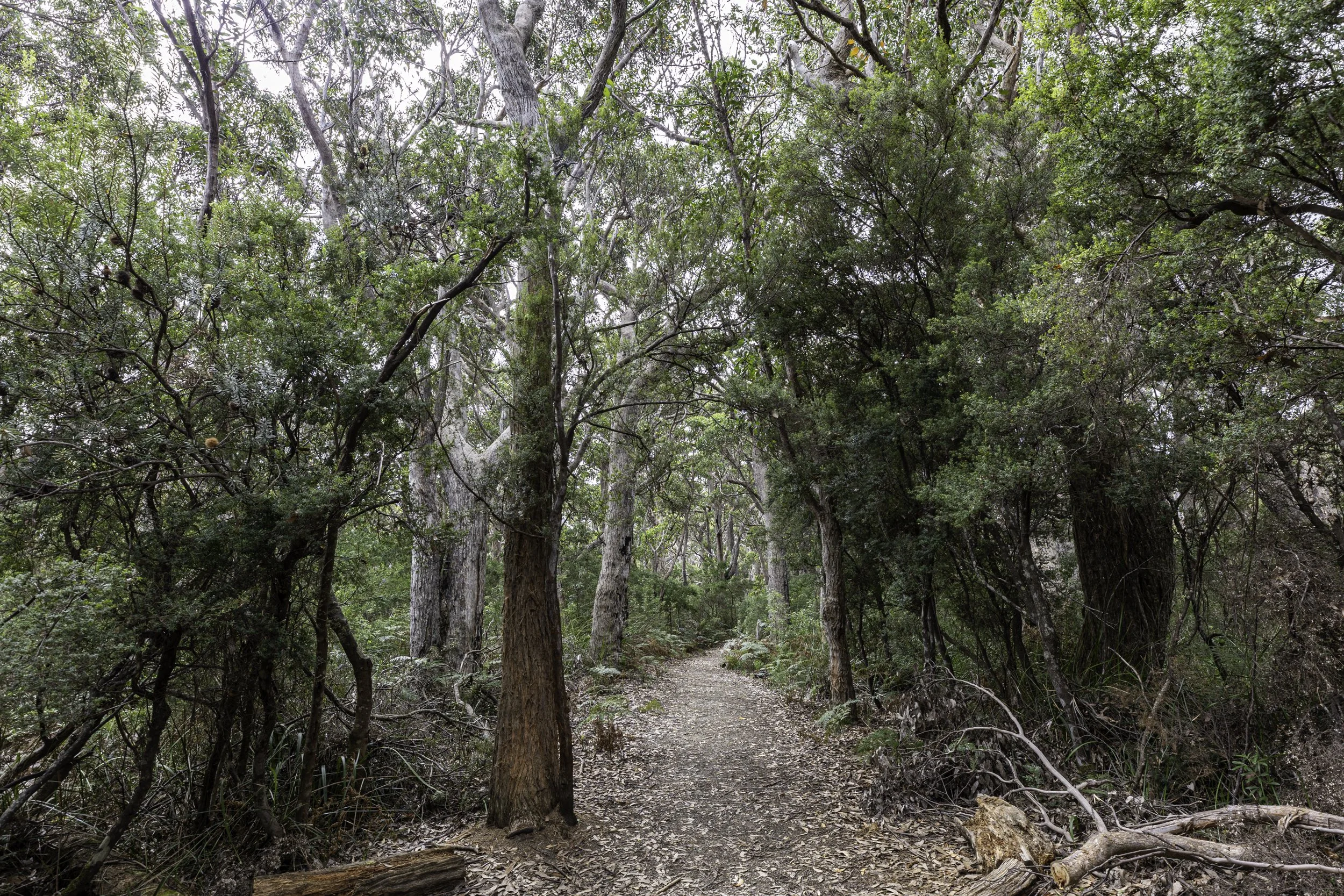
Day two, April 2023, on the Three Capes Walk is a 11km walk through varied landscapes. The path follows the coastline, through eucalypt forests and heathland. There are great views from Athurs Peak. The rain clouds gather but it stays clear. At Munro Cabin we are rewarded with an outdoor shower with hot water - bliss.


Postcard from Australia - Three Capes Walk Tasmania - Day One

Maingon Bay, Tasmania
In April 2023 I travelled to Tasmania with two photographer friends to do the Three Capes Walk. The walk takes four days, three nights and covers 48 kms in total. This was my first time doing a multi-day hike and I was a little nervous but it was an incredible experience. Please follow me for the next four days as I describe the walk and share some photos of a diverse and beautiful landscape.
We did the self-guided walk through the Tasmania Parks and Wildlife Service. It is a popular walk so you need to book ahead. Each night you stay in a different, environmentally sensitive, architecturally designed cabin. The sleeping cabins (4 and 8 bed dormitories) have bunkbeds, mattresses, hooks and benches. The communal kitchens are well appointed. You just need to bring food, bowls and cutlery and a tea towel. There are compostable toilets and one stop has an outdoor shower.
Day one is an easy 4km and starts at Port Arthur (entry included in cost of walk). A boat takes you across Maingon Bay to Denman’s Cove to start the walk. As we crossed the bay we were surrounded by dolphins. We got off the boat in the water in the cove, boots and socks tucked carefully away to keep dry. We then started the walk and were greeted by an echidna. An amazing start to our walk.


Port Arthur across the bay

An echidna


Paths alternate between gravel, stone and boardwalks. All are well maintained.

Surveyors Cabin

A lovely sunset at the end of day one.
Portrait of Humanity

For the last five years the British Journal of Photography has put together a book called the ‘Portrait of Humanity’ to ‘recognise remarkable portraits that capture the moments that make us who we are’. Volume 5 includes 200 images from across the world.
The book provides ‘a window into the lives of the subjects and celebrates the shared humanity that connects us all’. I am so excited to share that one of my portraits was chosen for the book. I was so fortunate to travel throughout Pakistan and to visit remote areas of Gilgit-Baltistan. The people we met and the hospitality we received will forever stay with me.
Follow the link below to see all 200 images. You can also purchase the book from Hoxton Mini Press.
https://www.1854.photography/2023/02/portrait-of-humanity-vol-5-shortlist-revealed/
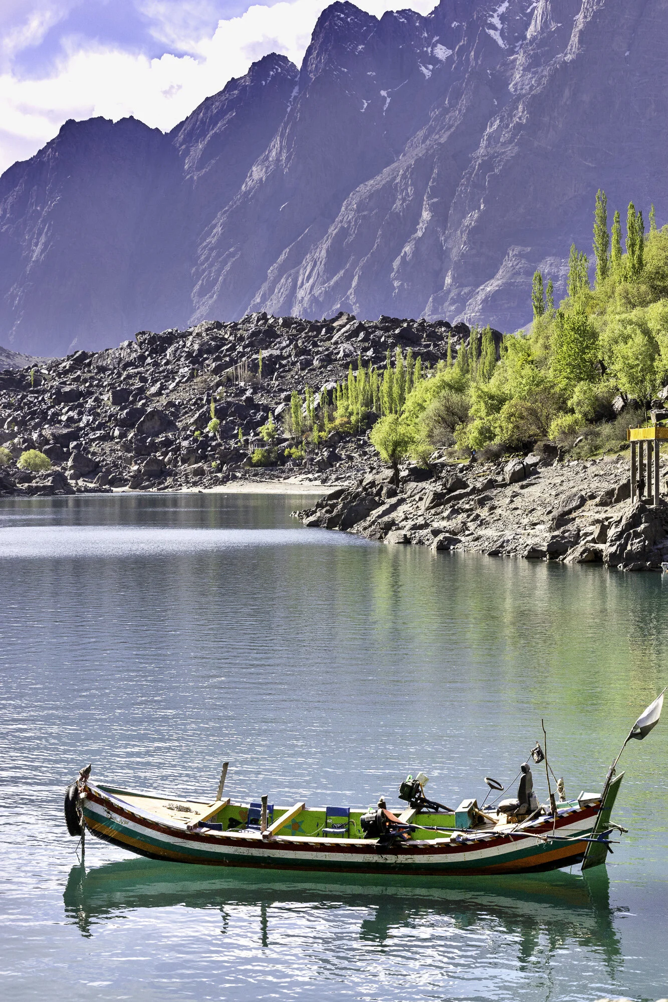
Postcard from Skardu - one day, two lakes

Upper Kachura Lake
Sadly our time in Gilgit-Baltistan is coming to an end. We have one full day left in Skardu before flying back to Islamabad. Skardu is a city surrounded by mountains sitting next to a wide valley floor at an elevation of 2,500 metres. In the local language of Balti Skardu means ‘a low land between two high places’. I was also told it could mean ‘star stone’ or ‘meteorite’. The landscape is dramatic as the Indus and Shigar Rivers meet here. The rivers keep changing shape as erosion from the Karakoram Mountains has left large deposits of sediment in the valley. We drive through the busy city and get caught in traffic jams caused by cars, people, and cows.
We are staying at the Shangrila Resort built around Lower Kachura Lake. When the sun hits the lake it is a bright green in colour. Upper and Lower Kachura Lakes sit side by side. We drive closer to Upper Kachura Lake and take the short walk down to the water’s edge. Boats sit ready to take visitors out on the lake, but we decide to enjoy the peace and quiet and sit and enjoy the wonderful view. On our way back to the car the path is filled with goats returning from grazing. We quickly move over and stand on a low wall and watch as they wander past.
The sun is beginning to set as we head back to the Shangrila Resort. We stop and buy some local dried fruit: cherries; sultanas; apricots; and walnuts. We sit outside our cabin and eat some dried cherries and start planning our return to this beautiful part of Pakistan.

Skardu Valley

Skardu City


Lower Kachura Lake, Shangrila Resort


Boating on Lower Kachura Lake


Lower Kachura Lake

Path on way to Upper Kachura Lake


Upper Kachura Lake

Flag with the face of Muhammad Ali Jinnah, known as the ‘Father of the Nation’


Flying out of Skardu

In the clouds, dreaming of our next visit north
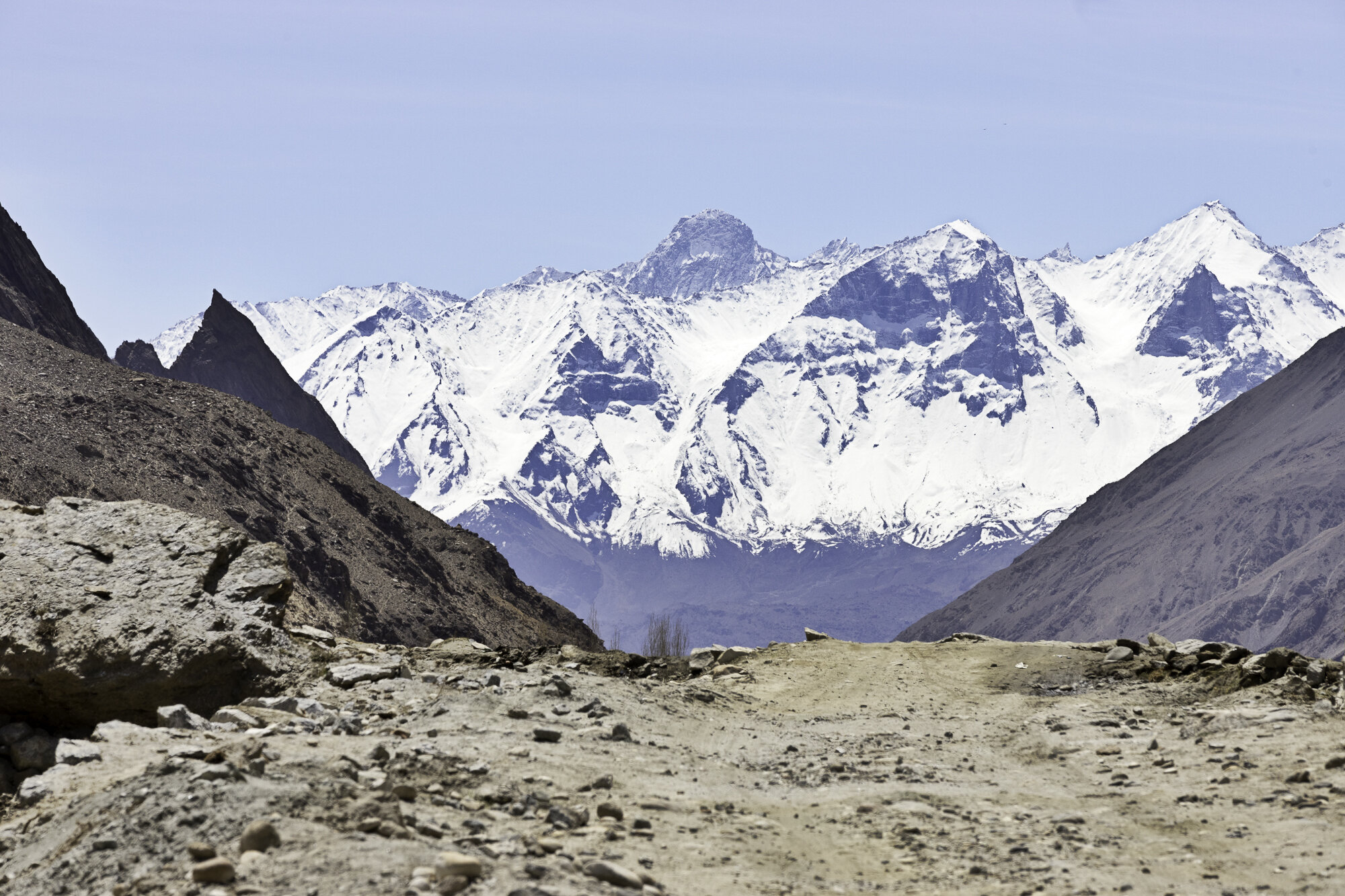
Postcard from Hushe Valley and Masherbrum, Queen of Mountains

I had never heard of the Hushe Valley in Gilgit-Baltistan. However, it is well known to the trekking and mountaineering community. Hushe Village sits at the very end of the Hushe Valley. Sitting behind the village is Masherbrum at 7821m. There is a well-known K2 base camp trek that starts at Askoli Village, trekking across the Baltaro Glacier, Concordia, finally crossing the Gondogoro Pass before arriving in Hushe Village.
We were not doing the trek. Instead, we were driving to Hushe Village from Khaplu. It is a 60 kilometre drive and you need to allow around 3 hours as the roads after Saling are single lane and most of the road is not paved. The Hushe River runs down the valley eventually meeting up with the Shyok River.
We left Khaplu and crossed the Shyok River at Saling. We stopped to take photos at Saling of the Ghursay Mountains. Ghursay is the local name for K7 (6934m), K8 (7422m) and K9 (7000m). There are many villages to stop and walk around along the way: Machlu; Talis; and Khand. As we wanted to reach Hushe and get back to Khaplu before dark we only stopped a couple of times to take photos. This turned out to be a good idea as on our return our car broke down. Somewhere along the very bumpy road we had lost a vital connector. Our wonderful driver, Shakeel, walked along the road, found a suitable piece of plastic and tied the parts together and we were able to get back to Khaplu.
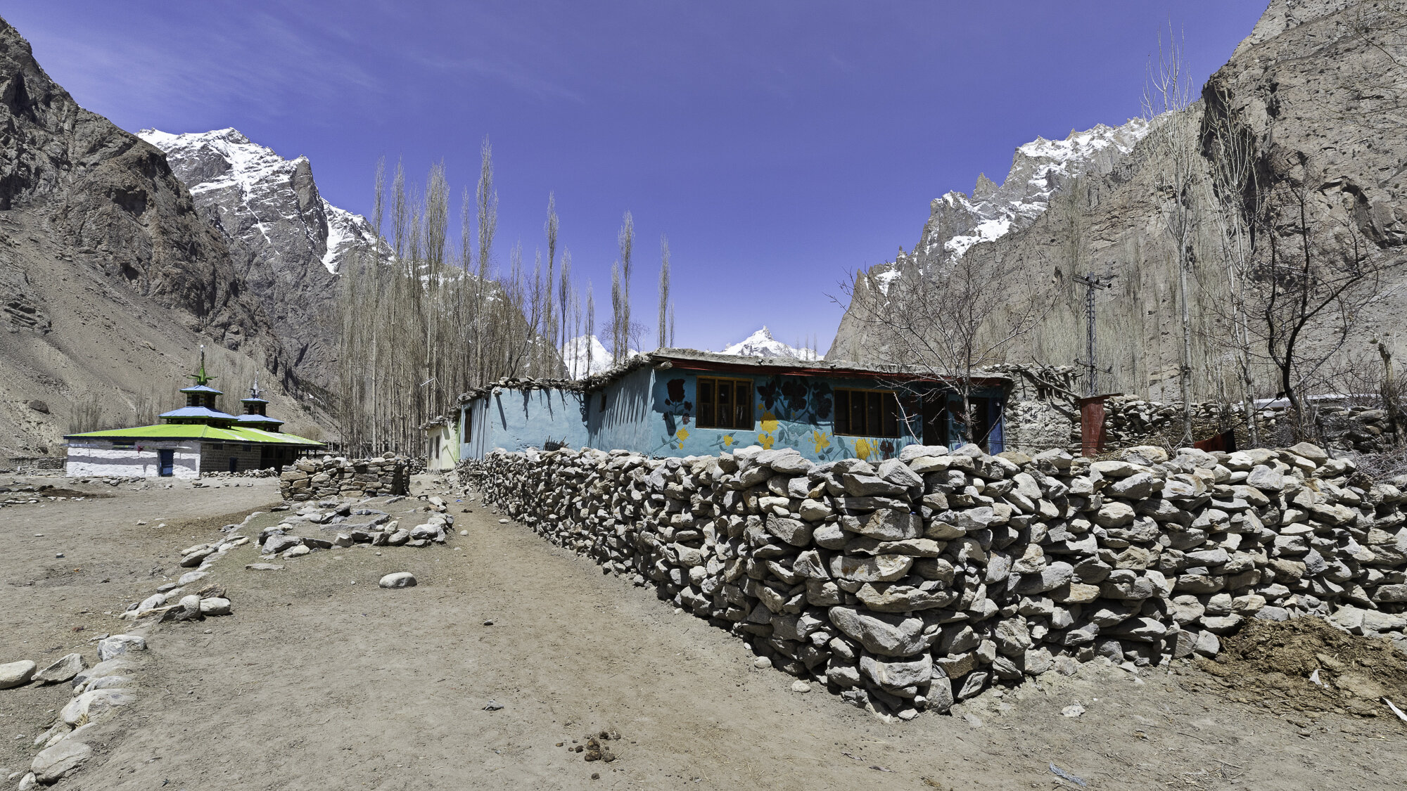
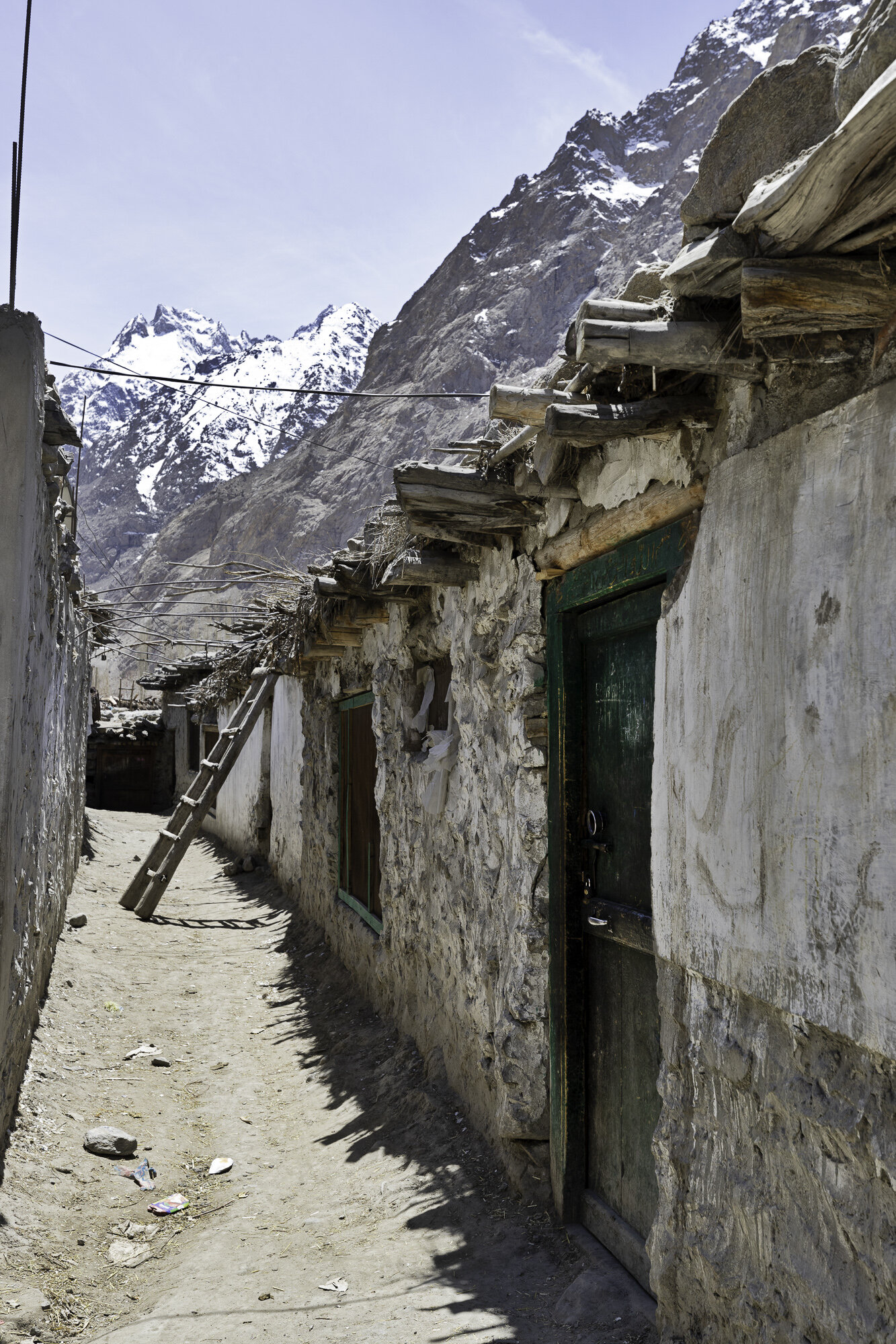
Our tour guide had organised for a local man to give us a tour of Hushe. Hushe is predominantly a farming community. In the 1960s villagers started working as porters and cooks for K2 expeditions. Expeditions brought work and money to this very remote community. However, covid has meant that the number of expeditions has significantly decreased. There is a primary and middle school, any further education must take place in Skardu, over 5 hours away. The cost is prohibitive for many families. The other major challenge for the village is water. There is only one water pump and this freezes over winter.
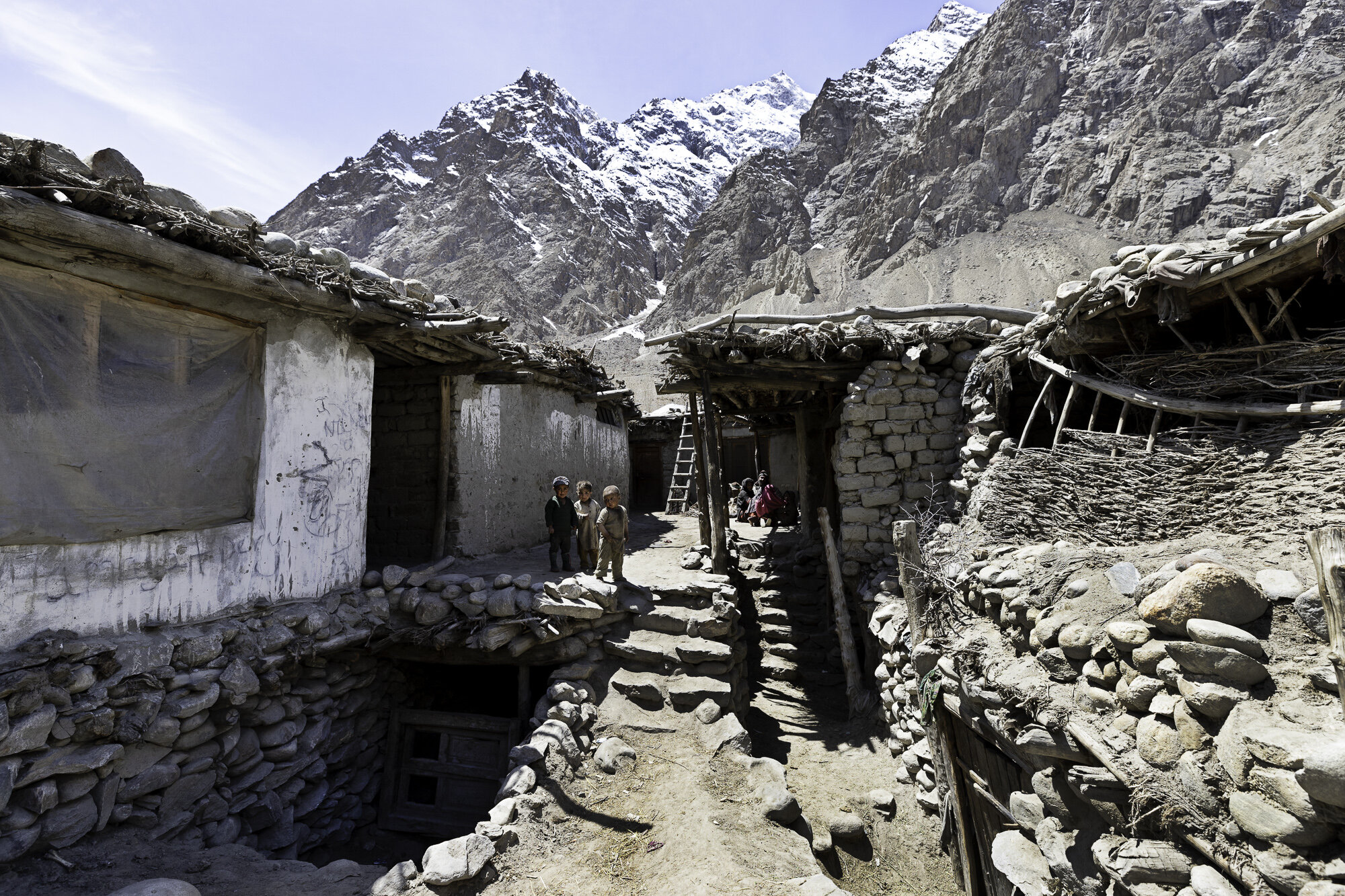
We stopped and talked to several people as we walked around the village. One woman was happy for me to take her photo but was insistent I do not post to Facebook. I was surprised that Facebook had made its presence felt in such a remote place. A grandmother was minding her grandchild and was very happy for her photo to be taken. The grandchild was not and cried and cried! As a mother and daughter sifted tea leaves, we were told of the process of growing and making the local green tea. A couple of cows became very interested in us and a small boy was dispatched to drive them away. We visited in late April and, at this end of the valley, it was still looking barren as this is the start of the planting season. Men and women were working together in the fields surrounding the village getting the soil ready. Villagers rely on these crops and the growing season is extremely short.
Wherever you walk in the village you feel the presence of the mountains and Masherbrum. Brum means mountain in the local Balti language. Many meanings have been given for Masher from ‘queen’ to ‘no sunlight’. If K2 is the ‘King of Mountains’ in Pakistan, then perhaps Masherbrum is the Queen.

Ghursay Mountains (K7 (6934m), K8 (7422m) and K9 (7000m))
Machlu Village

Machlu Village


Fields outside Machlu Village


Extra rocky part of the road

Apricot trees are left to soak in the mountain streams before planting
Spring seems a long way off

IFAD Project - apricot orchard
Looking back towards Saling
Hushe Village


I was very sorry that I made this poor child cry

Sifting green tea


Curious cows

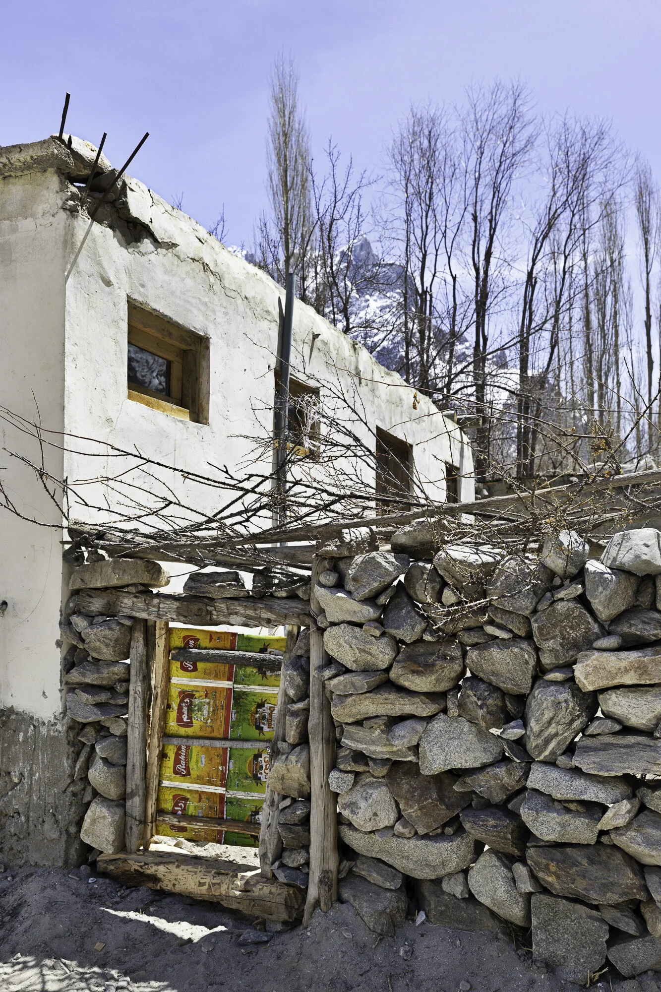
Tin cans used to make a very useful gate
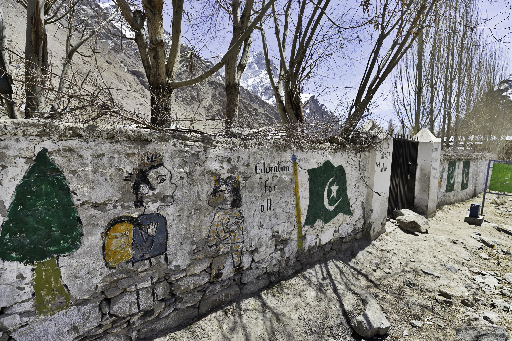
Education for all

Enter to read….leave to lead

Education is the best tool to change the world - Nelson Mandela
Education is the process to produce a sound mind in a sound body - Aristotle
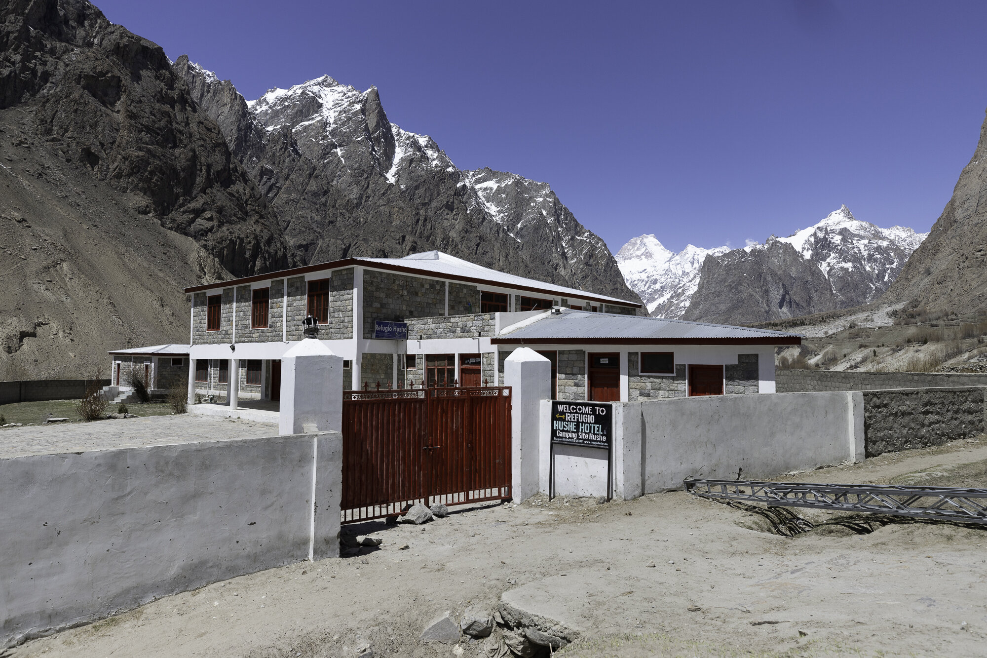
Refugio Hotel - a gift from the Spanish Government


Postcard from Thoqsikhar Mosque - a steep climb for the best green tea

We are staying in Khaplu that is in the Ghanche district, the easternmost district of Gilgit-Baltistan. To the north is China, to the south is Kashmir. I love hearing these beautiful sounding place names, even before arriving it sounded like a magical, exotic place.
If you visit this area of Pakistan you must bring your hiking boots with you as the best views can only be seen on foot. So we pulled on our hiking boots and set out to visit Thoqsikhar Mosque that sits high above the Khaplu Valley.
It is difficult to find any information in English about this five hundred year old mosque that sits at over 2,700 meters, high above the Khaplu Valley. The mosque is also known as Thoksikhar, Thoqsi Khar, or Thoksi Ghar. We drove to Gharbuchang Village to start the walk. Our guide, Mehrab, told us that it was a gentle walk and should take around 45 minutes to reach the top. The walk through the village was gentle, as was the first five minutes around the fields. Children peeked out from behind gates and a little goat followed us until a cow looked like more fun to play with. However the next 40 minutes of the walk was steep. It was hard work walking at altitude. I kept stopping to take photographs but it also gave me an opportunity to catch my breath.
Up and up we climbed. The views of the village and the valley kept getting better and better. Close to the mosque we were met by two local men who offered us tea and a place to sit and rest. We decided to keep going and stop on the way back. We finally reached the mosque and were able to enter and walk around the outside terrace. Past the mosque there is a short walk to reach the lookout where you get spectacular views of the Khaplu Valley. We enjoyed the cooling breeze, took more photos and then turned around to head back down before the sun set. At a small terrace a local, green tea was ready and waiting for us. We sat and enjoyed the tea and the view – both were wonderful.

Thoqsikhar Mosque sitting high above the Khaplu Valley

Gharbuchang Village
Gharbuchang Village


Gharbuchang Village


Looking back across the valley at Gharbuchang Village


Getting closer to the mosque


Gharbuchang Village and Thoqsikhar Mosque


Mehrab places a stone to celebrate that we made it this far.

Stopping to catch my breath


Thoqsikhar Mosque

Thoqsikhar Mosque

Entry to the terrace that surrounds the mosque


Inside the mosque


The lookout

Khaplu Valley

Down in the valley below we can see Khaplu Fort

Excellent maker of green tea

The tea, the view.
Postcard from Khaplu Village and Valley - a green, pink and turquoise walk

Khaplu is famous for its beautiful scenery and for being the gateway to trekking and mountaineering. It is also known for Khaplu Fort (see my separate blog on the Fort) and for Chaqchan Mosque. We wanted to understand the area better so we took a walk around Khaplu Village and then walked up the mountain behind the Fort to get a better view of Khaplu Valley.
The village was busy with women washing clothes and children running along the dusty paths hitting metal hoops to see how far they would roll. Men were sitting in front of their shops chatting with each other.
As we walked past local houses we saw what looked like a noughts and crosses game written on the walls or doors but instead of the usual noughts and crosses the grid was filled with a jumble of letters and numbers. I asked what it meant and was told it was a way of keeping track of immunisation and census records for that house. Written records, including a vaccination card for each child, are kept but the wall markings make sure no child is left out of a vaccination drive.
We were hoping to see inside Chaqchan Mosque. However, a sign outside stated ‘no admission for non-Muslims’. I was disappointed as I had read a lot about the Mosque that was built in 1370 and is one of the oldest in the region. Chaqchan means ‘Miraculous Mosque’ maybe one day we can return to see why.
We kept walking along a track that starts at the polo field and climbs up the mountain. The walk is steep but wonderful as you get amazing views of the village and the valley. At the top we kept walking along the main road until we reached rocky orchards and fields, all surrounded by mountains. We stopped and sat on a stone wall and enjoyed a well-earned rest. As we looked over green fields, pink blossoms, snow-capped mountains, and a turquoise blue farmhouse it was easy to agree that Khaplu is a beautiful place to visit.

Khaplu Village - each house a different colour

I always ask if I can take someone’s photo. This lead to a long discussion and the group decision was this man was the most photogenic.

Immunisation records on door

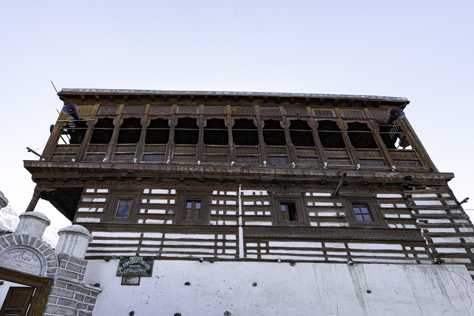
Chaqchan Mosque


The edge of the track up the mountain

Khaplu Valley - the view was worth the walk from the village below


A wonderful place to sit


Postcard on Pakistan Independence Day

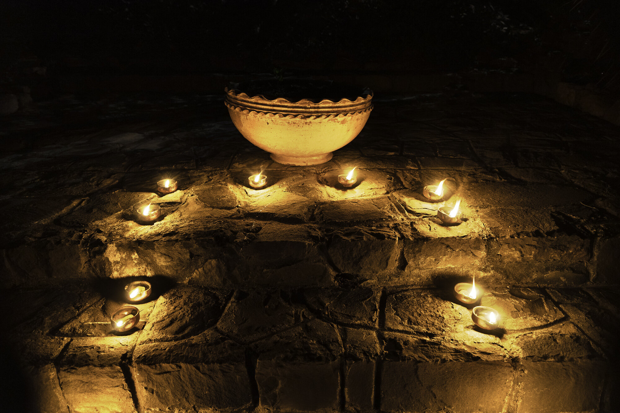
Today is Pakistan’s Independence Day. It has been 74 years since independence and today will be a day of celebration. Over the last week stalls have appeared at the sides of the roads selling flags, lamps, bunting and horns. People decorate their homes, cars and bikes.
Government buildings, landmarks, and homes are also decorated with lots of fairy lights. It is also a tradition to light diyas. Diyas are small lamps made out of clay, with a cotton wick dipped in vegetable or mustard seed oil. Diyas are considered to be a symbol of hope. They are lit for celebrations, including weddings and religious festivals, and at prayers at Sufi shrines.
So we lit diyas for Pakistan Independence Day. We celebrate with Pakistan and hope for a prosperous and peaceful future.


Postcard from Khaplu Fort - where the stone stopped rolling

During our drive across Gilgit Baltistan we’ve been able to see some amazing forts: Baltit and Altit Forts in Hunza; Shigar Fort and now Khaplu Fort (see my other blogs on each of the forts).
Khaplu Fort, like the other forts in the region, has been restored by the Aga Khan Cultural Service Pakistan. This fort is yet another example of painstaking restoration. The fort is set in Khaplu Village near the banks of the Shyok River and is surrounded by fields and orchards. In the village you can stand and turn and have 360 degree mountain views. You can see Masherbrum, K-6, and K-7 and other mountains with beautiful names like Sherpi Kangh, Siachen and Saltoro Kangri.
The local name for Khaplu Fort is Yabgo Khar, also known as ‘The Fort on the Roof’. The local story is that a stone was rolled down from a nearby mountain and where the stone stopped they built the fort. Built in the 1840’s for the local ruler Yabgo Raja Daulat Ali Kahn, it replaced an older fort. The fort showcases the many different styles of the region: Tibetan; Balti; and Kashmiri.
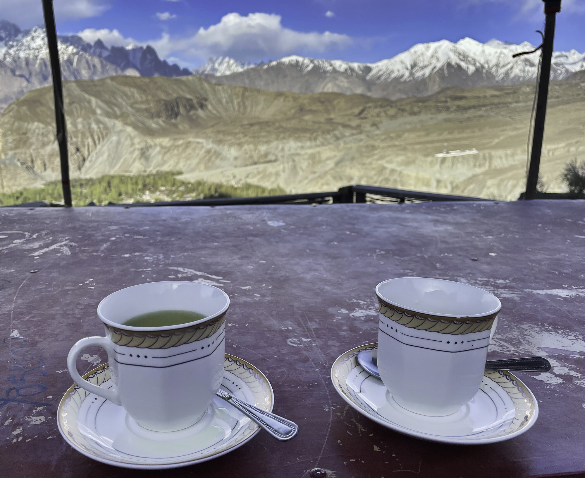
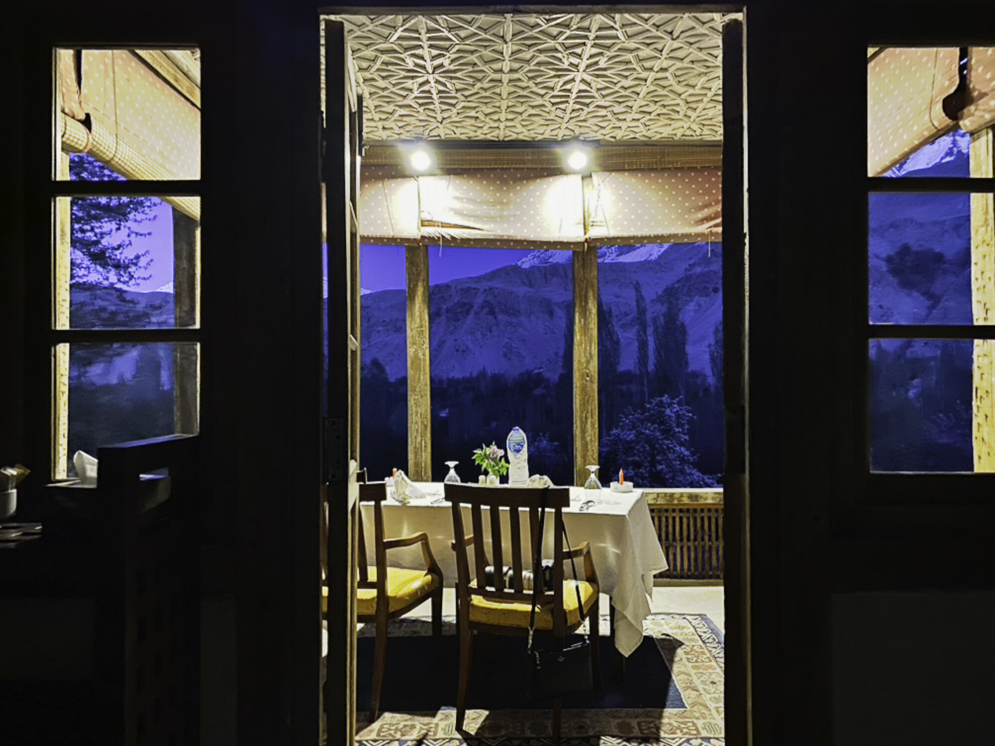
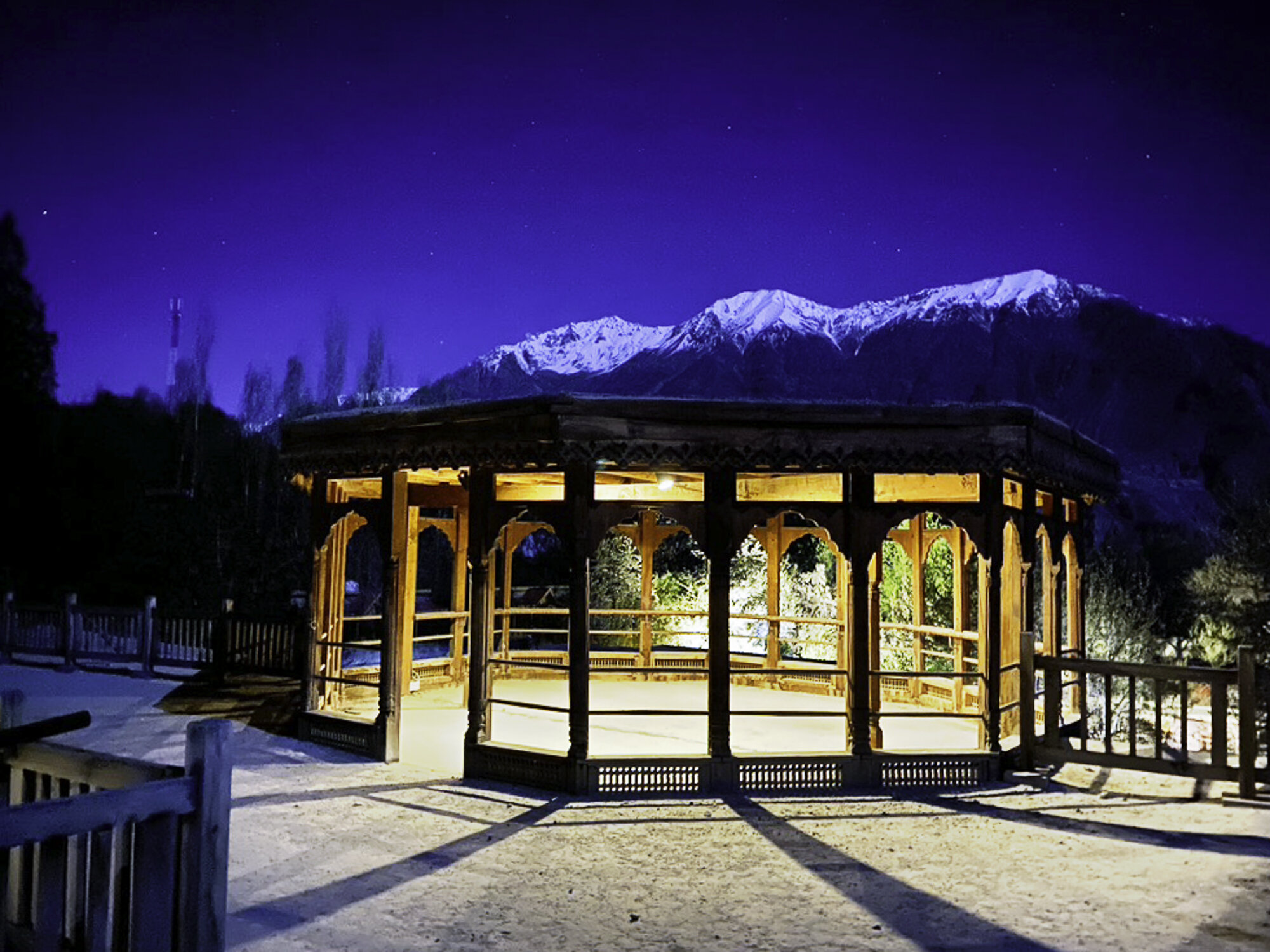
Today the Fort is run by Serena Hotels. We stayed for three nights to explore the region. We had a wonderful stay there. What an experience to drink tea on an intricately carved wooden balcony and to sit on the top terrace and watch the moon rise over the mountains. Khaplu Fort, where the stone stopped rolling, and, if you can, you should stop there too.


Main Gate

Entrance to Khaplu Fort

Khaplu Fort garden


Khaplu Fort restaurant

A lovely place to sit and enjoy a meal

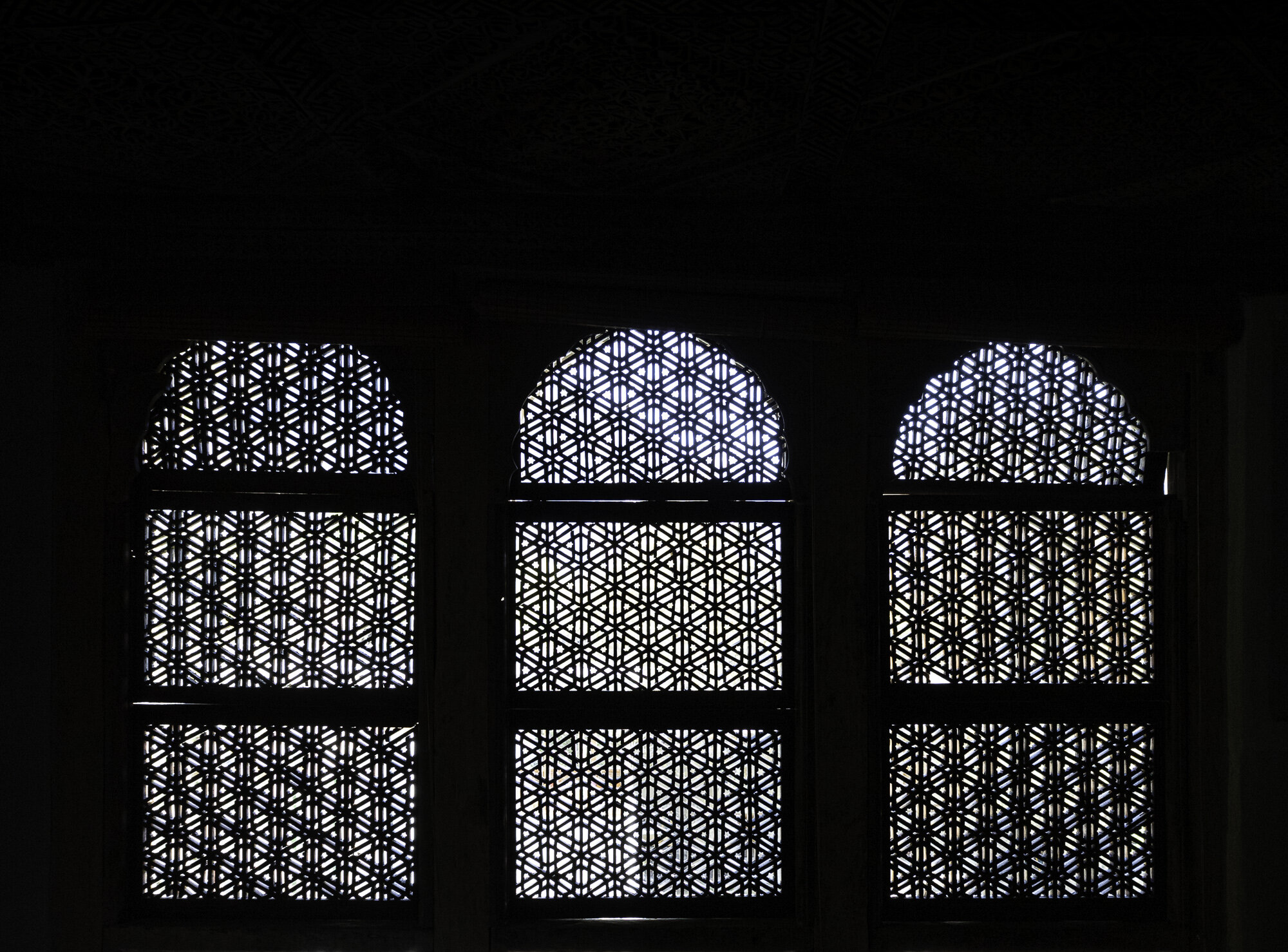
Wooden lattice work

Doors open to a spectacular balcony and view


We sit and enjoy our tea

Ceiling detail


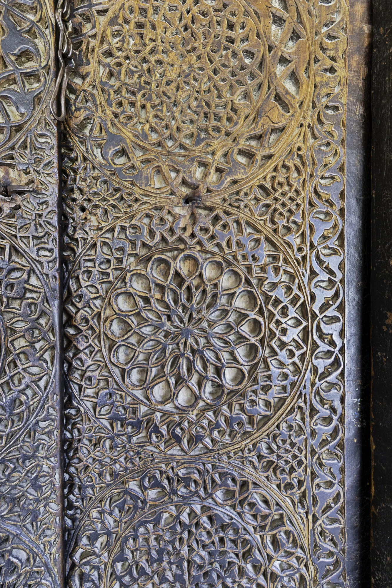
Door detail

Everywhere you look there are interesting details and objects. These boots a reminder that the sun doesn’t always shine here.


Ceiling detail

Our favourite breakfast spot
A little cool in the mornings but we had to sit outside as it was such a gorgeous view

Night falls
A romantic dinner for two was organised and we sat and watched the moon rise


Postcard from Keris - the door to heaven

We say a fond farewell to Shigar and get ready to drive the two hours, 104 kilometres, to Khaplu where we will be staying for the next few days.
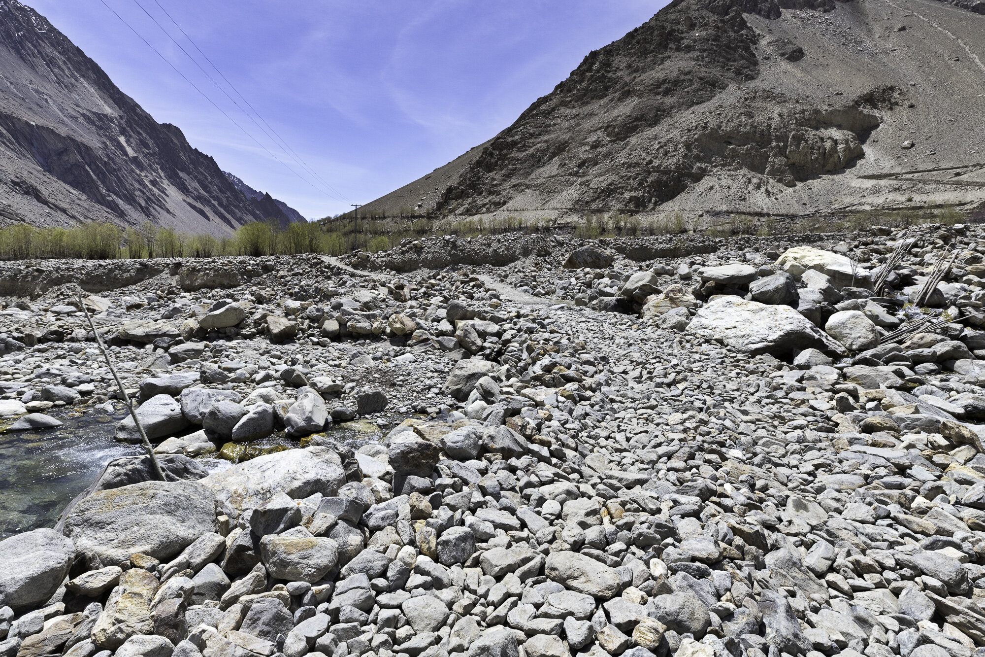
The two-hour drive takes us close to four hours as I want to stop so many times to take photographs. The scenery continues to be stunning but the road is not. The road is only paved in parts and the rest was very bumpy, so much so that my Fitbit congratulated me on doing my daily target of 10,000 steps.
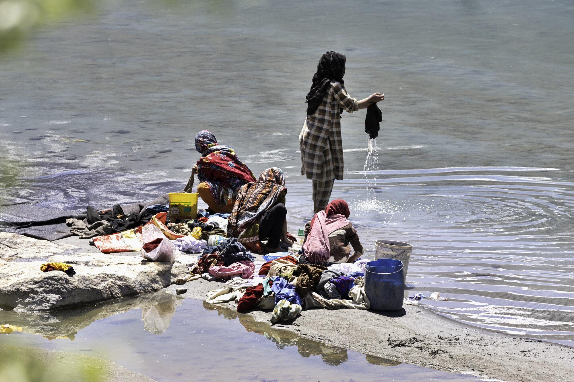
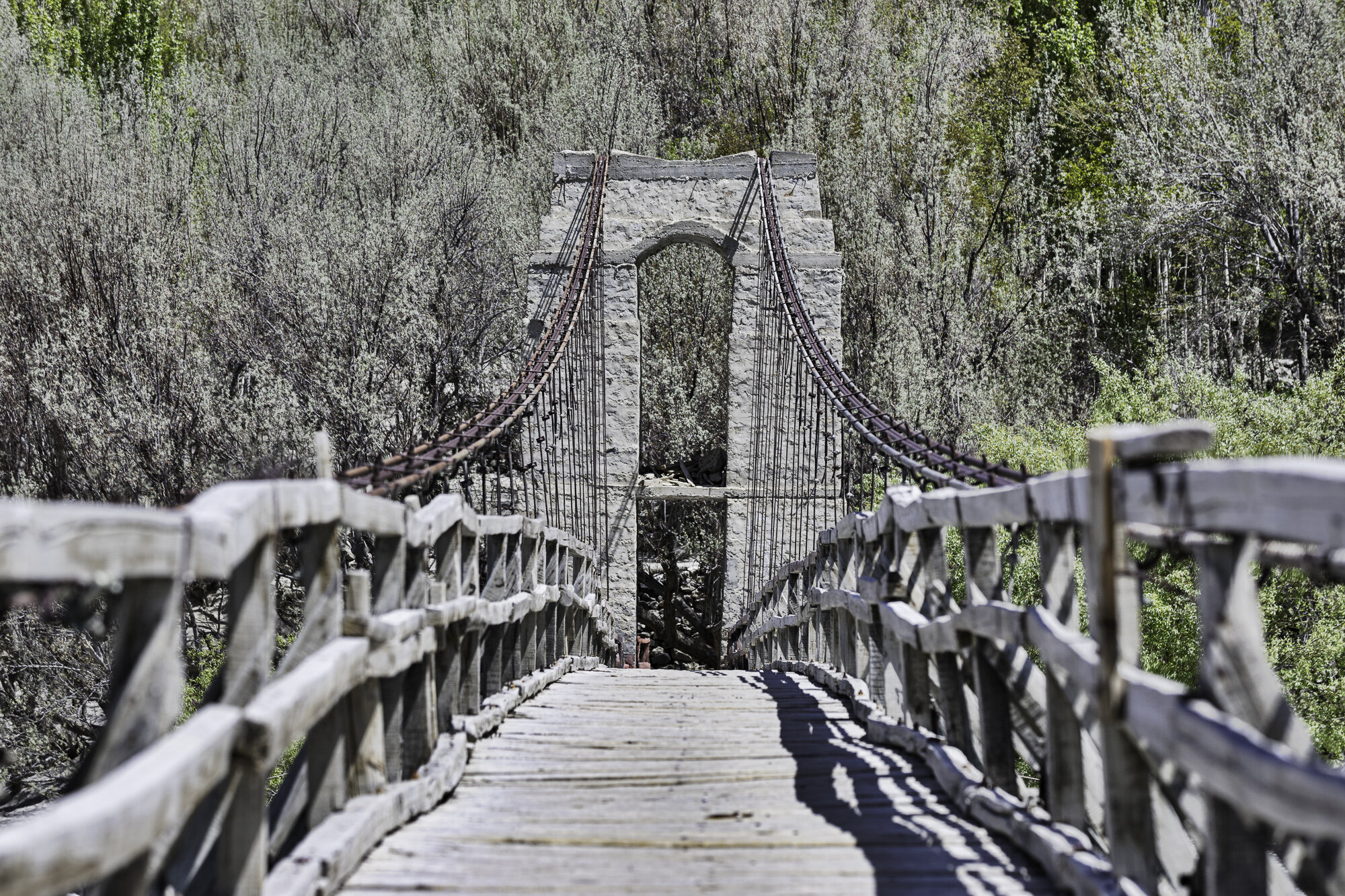
My favourite stop was at the Keris pedestrian bridge, suspended over the Shyok River. We walked across the bridge in the bright sunshine. It was obviously a good day to do washing as many women were by the river’s edge washing clothes in the icy river and draping them over hot stones to dry. Keris is at the confluence of the Indus and Shyok Rivers. As you sit and look at the bridge and the turquoise river, your eyes move up past the beginning of the green valley to snow capped mountains. You can see why the bridge has been called ‘the door to heaven’.

Leaving the green Shigar Valley

Under all that hay is a house. Limited land means using every available surface for drying.

Gol Village in the Indus River


Stopping at Keris

Keris pedestrian suspension bridge


The green-blue bend of the Shyok River

Keris road suspension bridge in the background


Ghawari


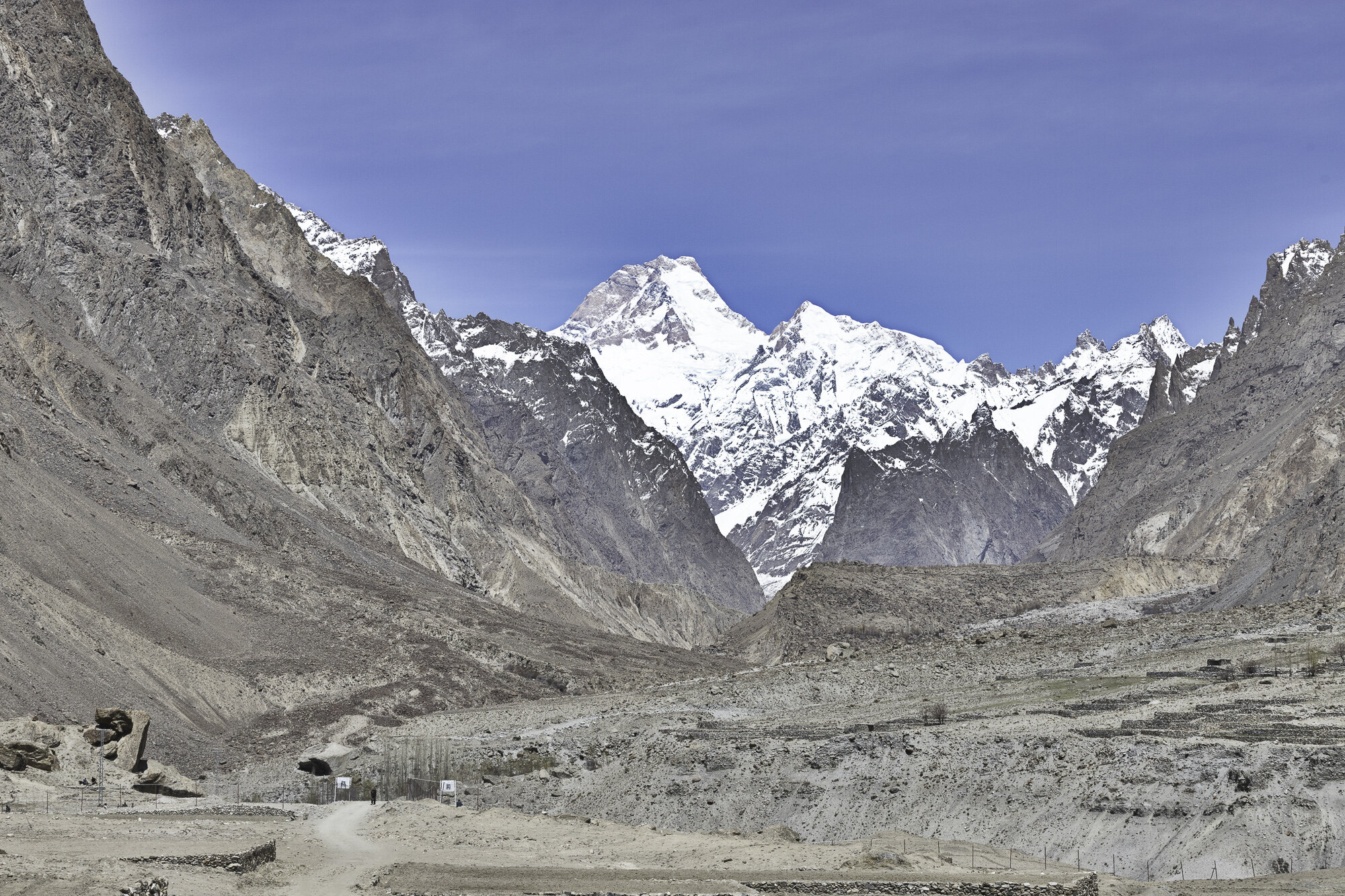
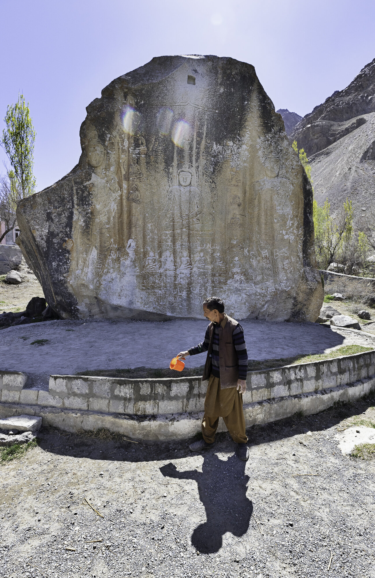
Postcard from the Manthal Buddha - a rock and a desert

The Manthal Buddha can be found just outside the village of Manthal, near Sadpara Lake. Buddhism came to the region in the late 7th century. Buddhists travelled throughout the Indus Valley, and you can see rock carvings and stupas across Gilgit-Baltistan. Two of the most famous sites are the Manthal Buddha and the Kargah Buddha (the subject of a previous blog).
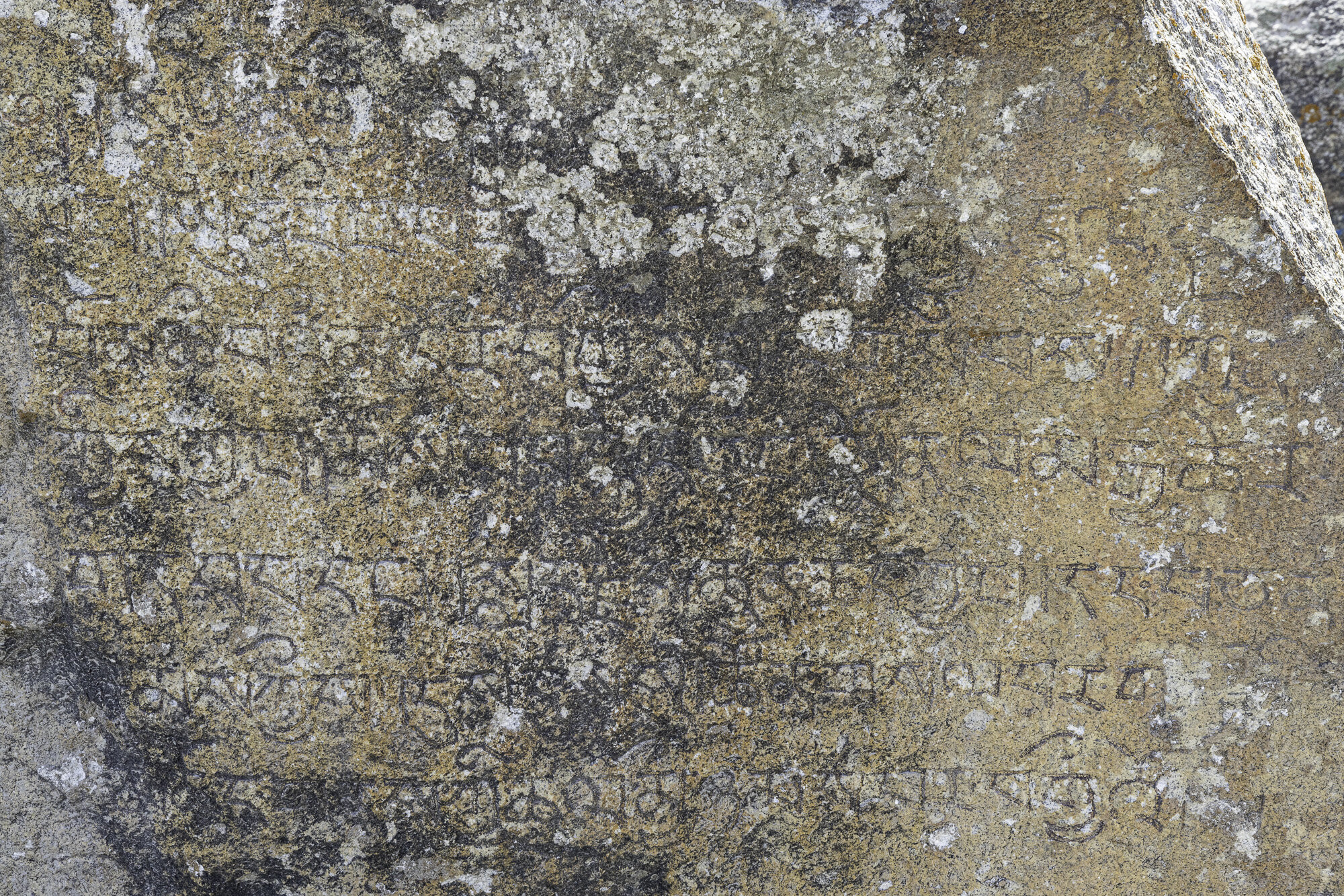
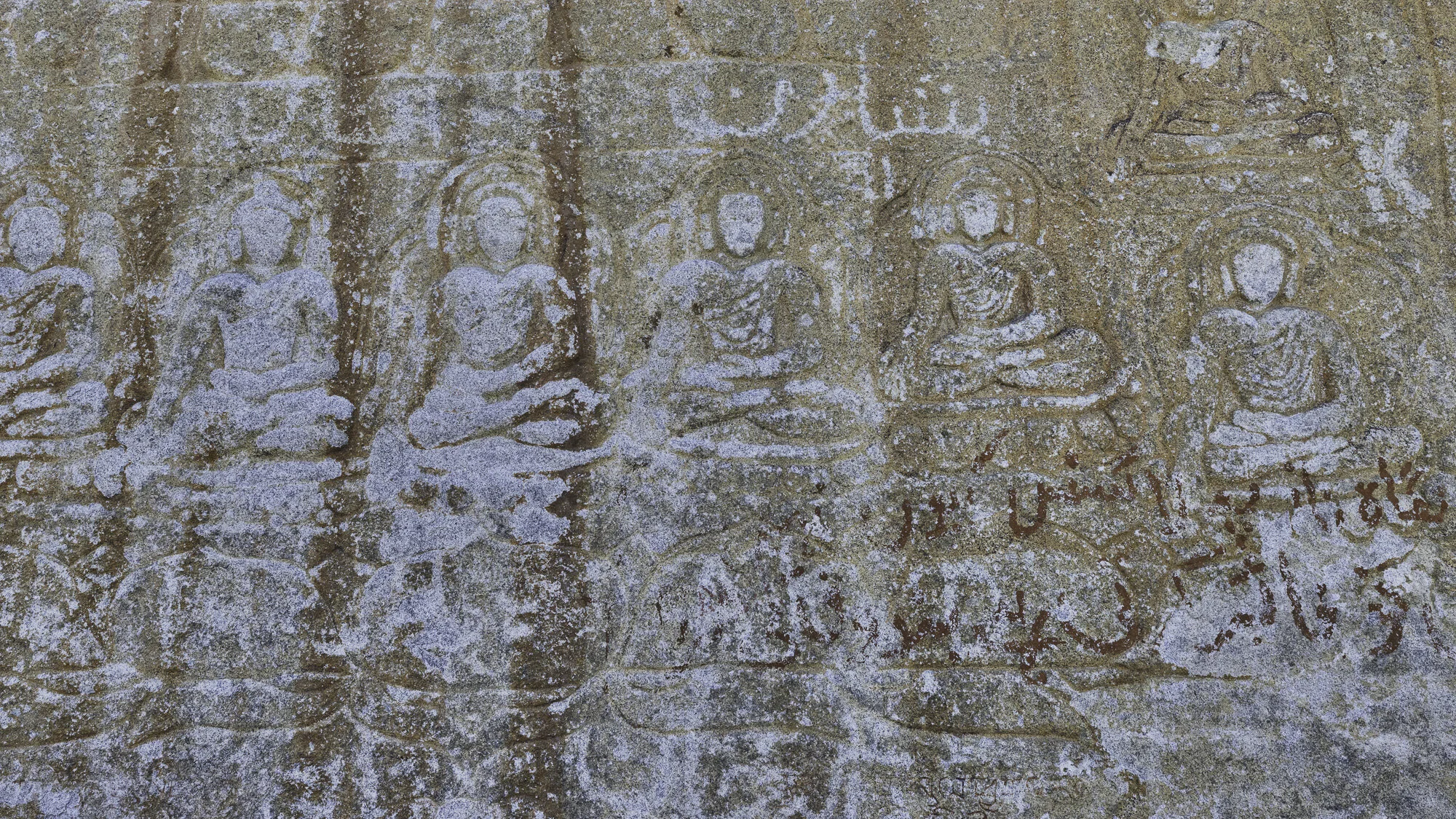
The Manthal Buddha was carved in the 9th century, during the ‘golden age of Buddhism’ in the region. The rock is in the shape of a triangle and is approximately 6 meters wide and 9 meters high. The carving on the rock shows a meditating Buddha surrounded by smaller Bodhisattvas (past buddhas) and two standing Maitreyas (future buddhas). At the bottom of the rock are some Balti inscriptions. The carving is a Mandala, a representation of the universe and an aid to meditation. The local village Manthal is named after the carving.
The Buddha Rock is surrounded by a wall and there is a custodian. I was pleased to see that the local government has taken steps to preserve and protect the site. Some Buddhist sites have been vandalised in Pakistan as they are considered to be un-Islamic.
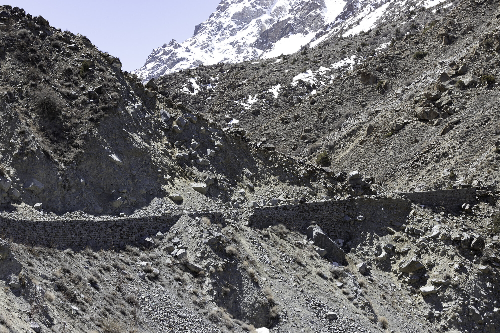
On the way back to Shigar we stopped to look at the Sarfaranga Desert, known as a cold desert, during the winter it can be covered with snow. The landscape is dry and dramatic. Desert surrounded by mountains. We visited in late spring, and you could feel the warm wind crossing the sand. It is hard to imagine that snow could fall here. Maybe one day I can return to photograph what would be an amazing sight of a desert covered in snow.
Manthal Buddha and custodian


Sarfaranga Desert, mountains to the front and back

Sarfaranga Desert

Sarfaranga Desert
Postcard from Sadpara Village - a tribute to Ali Sadpara

‘In climbing there are two outcomes, life or death, and you must find the courage to accept either possibility’. Muhammad Ali Sadpara
We had planned a day trip to Deosai National Park but multiple rockslides on the road meant we had to turn back to Shigar. The change in plans gave us the opportunity to spend more time at places of interest along the way.
We stopped first to look down at Sadpara Village, also known as Satpara. From the road you look across the valley. Colourful houses gathered closely together surrounded by terraced fields. We stood and appreciated the work involved in creating neat rectangles of fields, some bright green, some recently tilled, edged by stone walls. As the valley walls become steeper the fields become narrower and the walls higher. Water channels provide irrigation from streams to the fields.
It was in Sadpara Village that Muhammad Ali Sadpara was born in February 1976. It is easy to see when standing in his village, surrounded by mountains, why Ali Sadpara became a mountaineer. He started as a porter, carrying heavy loads for expeditions to the Boltoro Glacier and K2, then progressed to leading expeditions. His mountaineering achievements are numerous and include climbing eight of the fourteen ‘eight-thousanders’.
In November 2020 we were lucky enough to meet Ali and hear him give a talk about his climbing life. He was quietly spoken and modest about his achievements. It was only when you see some of the video footage from his climbs that you realise what an amazing but dangerous occupation Ali had chosen.
In January and February of 2021 Ali and his son Sajid planned another expedition to K2 along with the Icelandic mountaineer John Snorri and Chilean mountaineer Juan Pablo Mohr. On 4 February Sajid returned from the highest camp due to equipment problems while the other three pushed on to the summit of K2. They failed to return and despite rescue missions have not been found. The whole of Pakistan mourned the loss of its most successful mountaineer and a family their dear husband and father.
"To all the climbers... who look up to him. I promise I will carry on his dreams and mission and continue to walk in his footsteps." Sajid Sadpara
Postscript: It has been reported in the media today that the bodies of Ali Sadpara, John Snorri and Juan Pablo Mohr have been found just above the area known as the Bottleneck on K2. May you all now rest in peace.
Road to Deosai, whole parts of the road ripped away

I’m not sure why I am smiling as these huge boulders blocked our way to Deosai.

Sadpara Village on the far right, tucked in close to the mountain side

Sadpara Lake in the distance


We round a corner and there is this beautiful bridge


Our wonderful guide Mehrab willing to climb out on a rock so that I can get a great shot

A less adventurous photo


Ali Sadpara, event hosted by the Canadian High Commission, November 2020

Sadpara Lake
Postcard from Shigar - one village, two historic mosques

Khilingrong Mosque
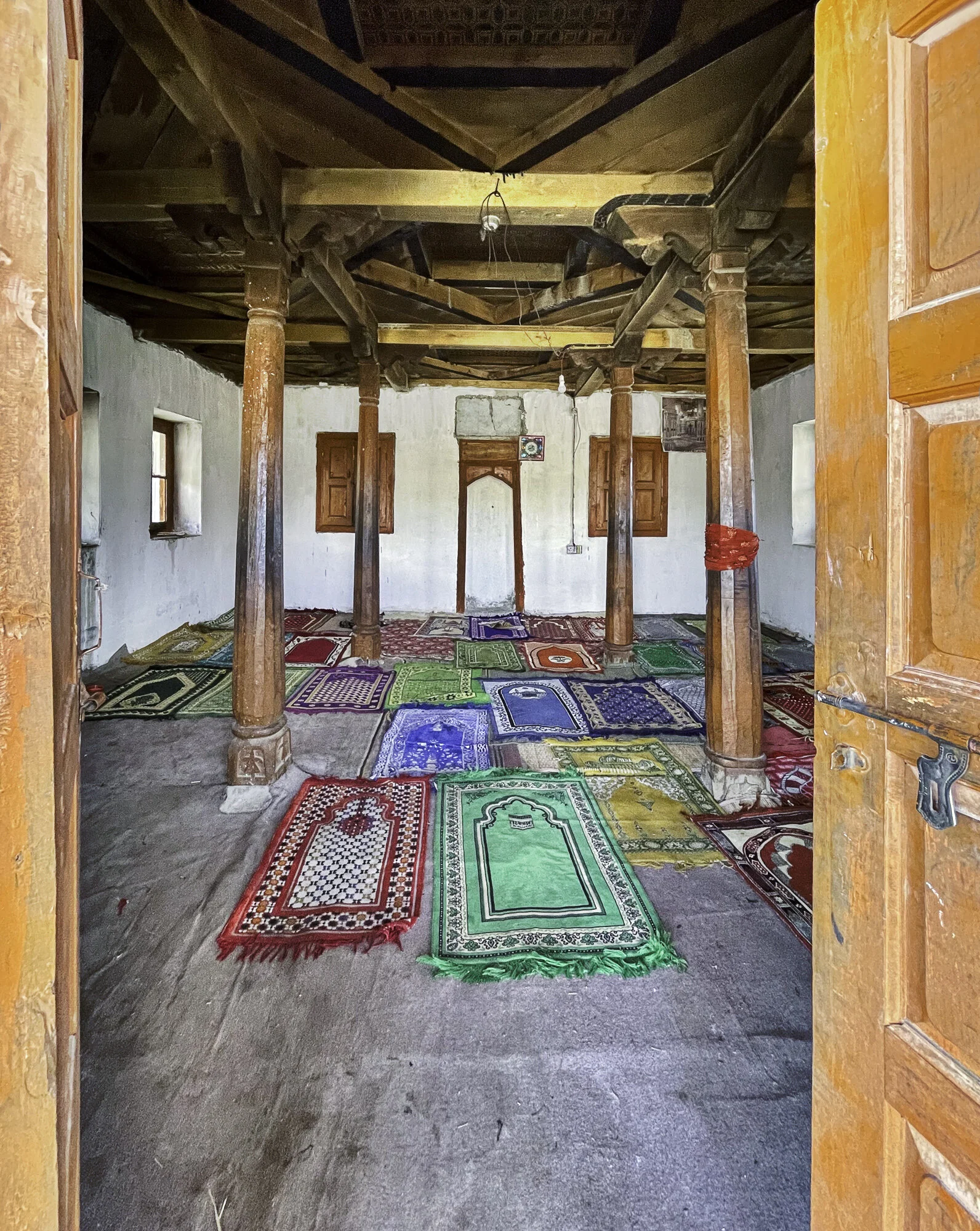
Before travelling to Shigar I had read about the Shigar Fort. What I hadn’t read about were the two historic mosques, Khilingrong and Amburiq.
As we walked around Khilingrong Mosque, built over 400 years ago, we admired the unusual design. It has two stories, the lower story used during winter and the upper story used in summer to take advantage of any breeze. While the verandah on both levels is made from intricately carved wood, the inside is made from the traditional method of building alternate levels of wood and stone. Instead of four minarets there is a central tower that is Tibetan in design. The mosque was in falling into disrepair when the Aga Khan Cultural Service of Pakistan (AKCSP) stepped in to renovate and save this mosque. The AKCSP helped train locals in traditional, and highly specialised restoration and it also meant the mosque could be used again by the community.
The second mosque we visited was the Amburiq Mosque, 800 years old. According to the sign outside the mosque it was built by Irani craftsmen travelling with a Persian Sufi saint, Mir Syed Ali Hamdani. Again, you can see Kashmiri, Tibetan and Persian designs in the building with another lovely Tibetan tower on the top. The mosque is another example of the award winning work of the AKCSP with funding from the Norwegian Government.
The Aga Khan Cultural Service of Pakistan should be commended for the restoration work they undertake, saving historical buildings in ways that benefit the community through skills training and preserving Pakistan’s rich and varied history.

Upper level, Khilingrong Mosque

Front facade, Khilingrong Mosque

Entry, Khilingrong Mosque


Front door, Khilingrong Mosque

Amburiq Mosque, front entry

Side view, Amburiq Mosque

Layer upon layer of restored woodwork, Amburiq Mosque

Front entryway, Amburiq Mosque

Front door, Amburiq Mosque
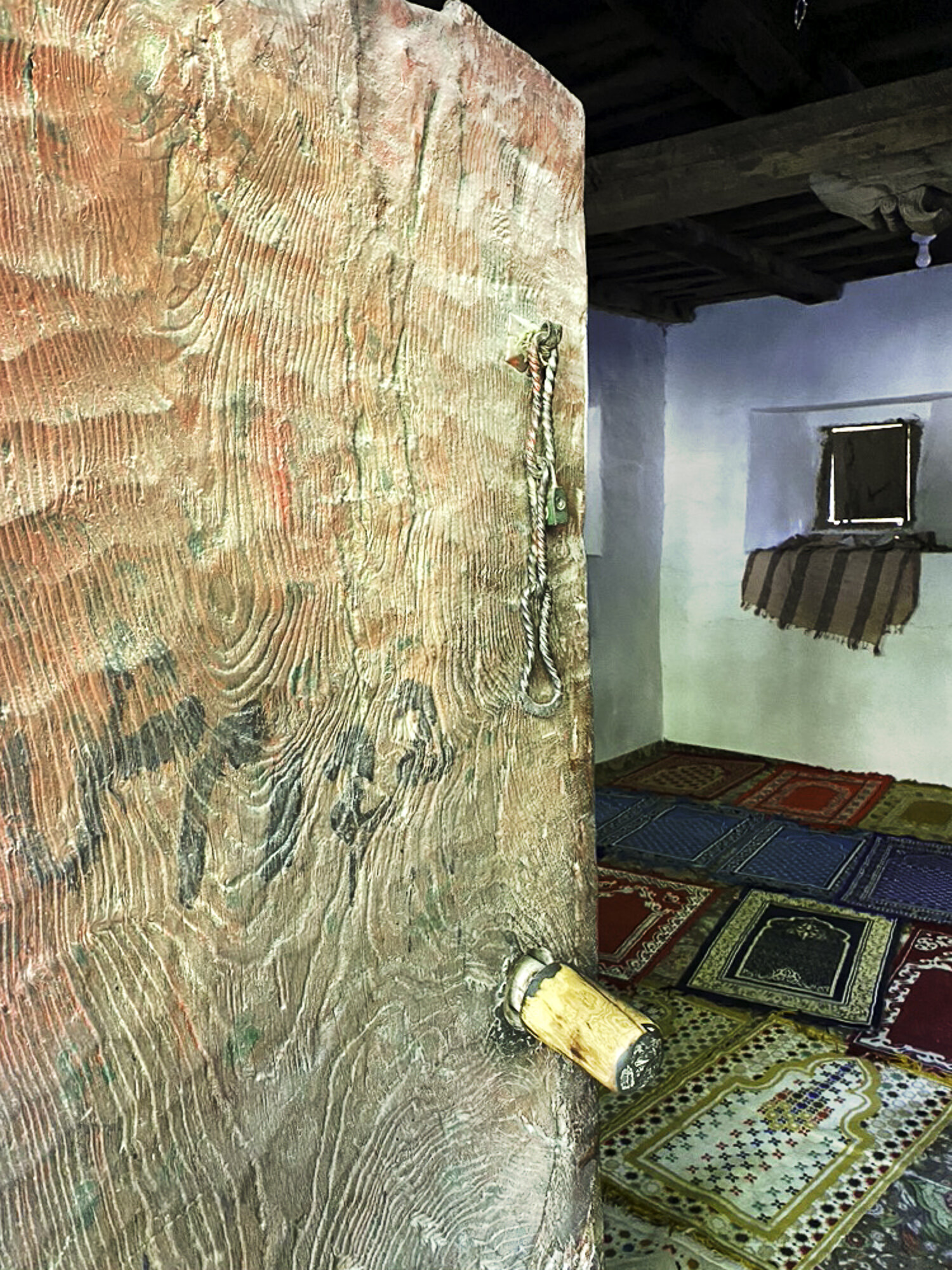
Inside Amburiq Mosque
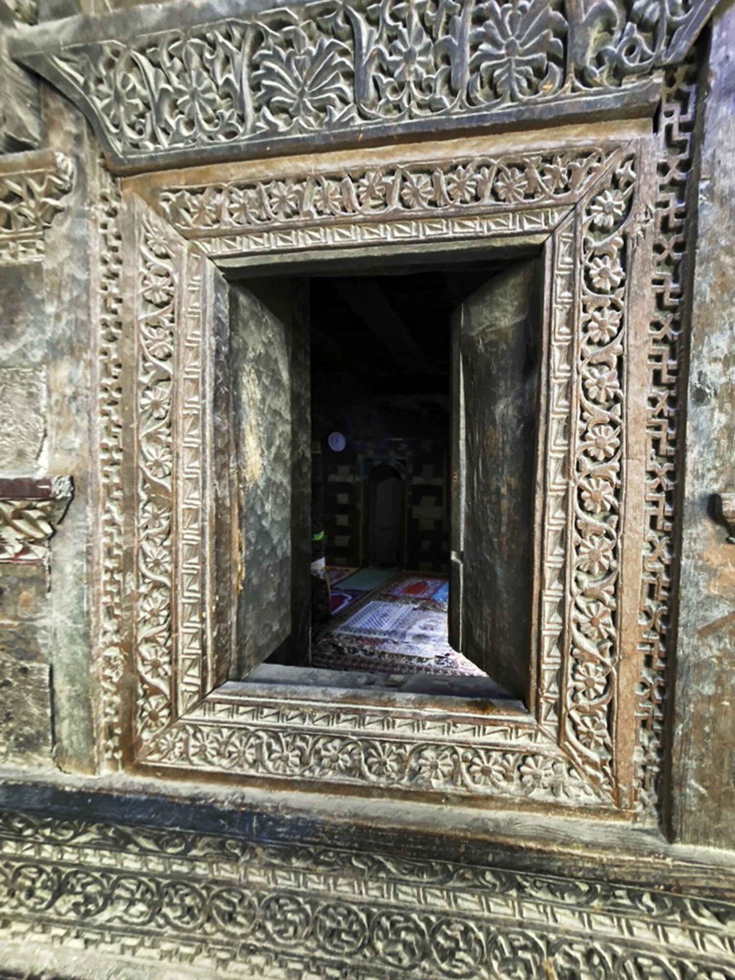
Window detail, Amburiq Mosque
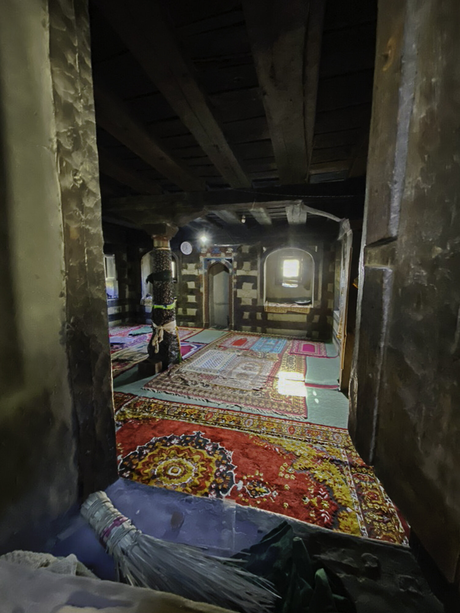
Inside Amburiq Mosque
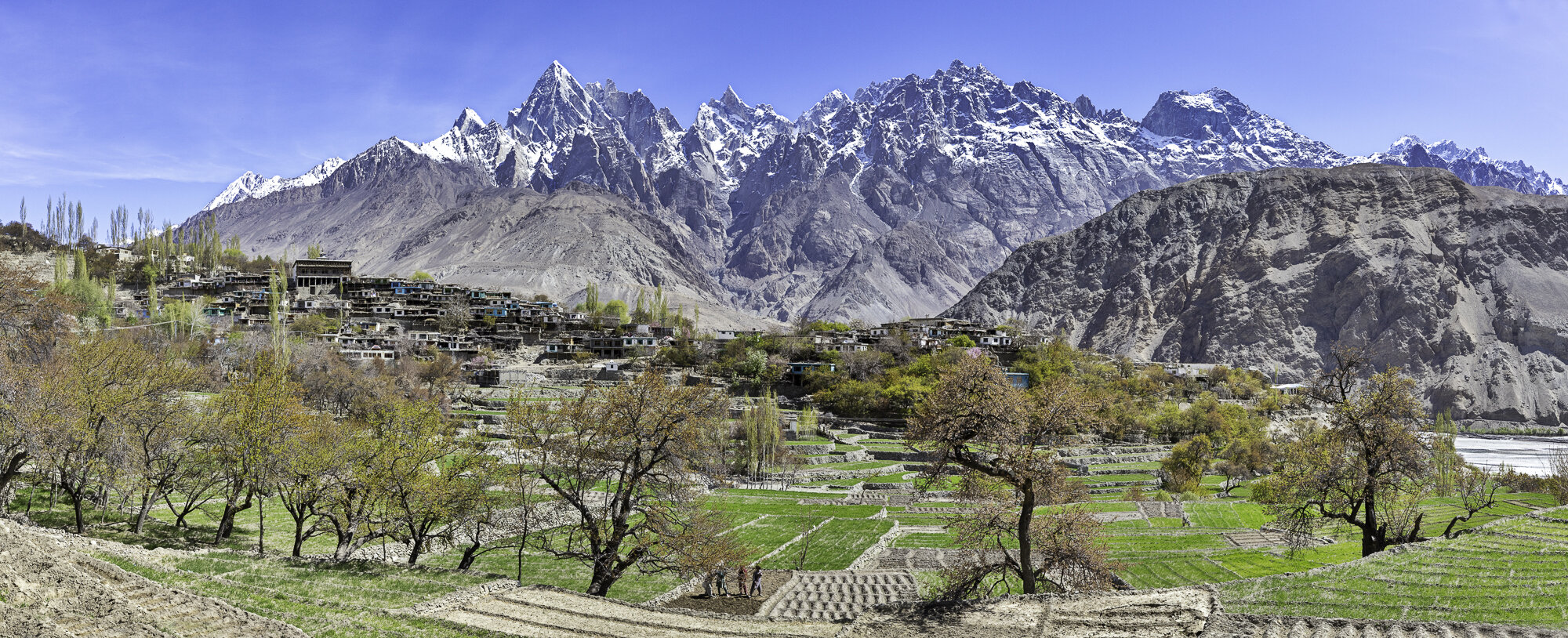
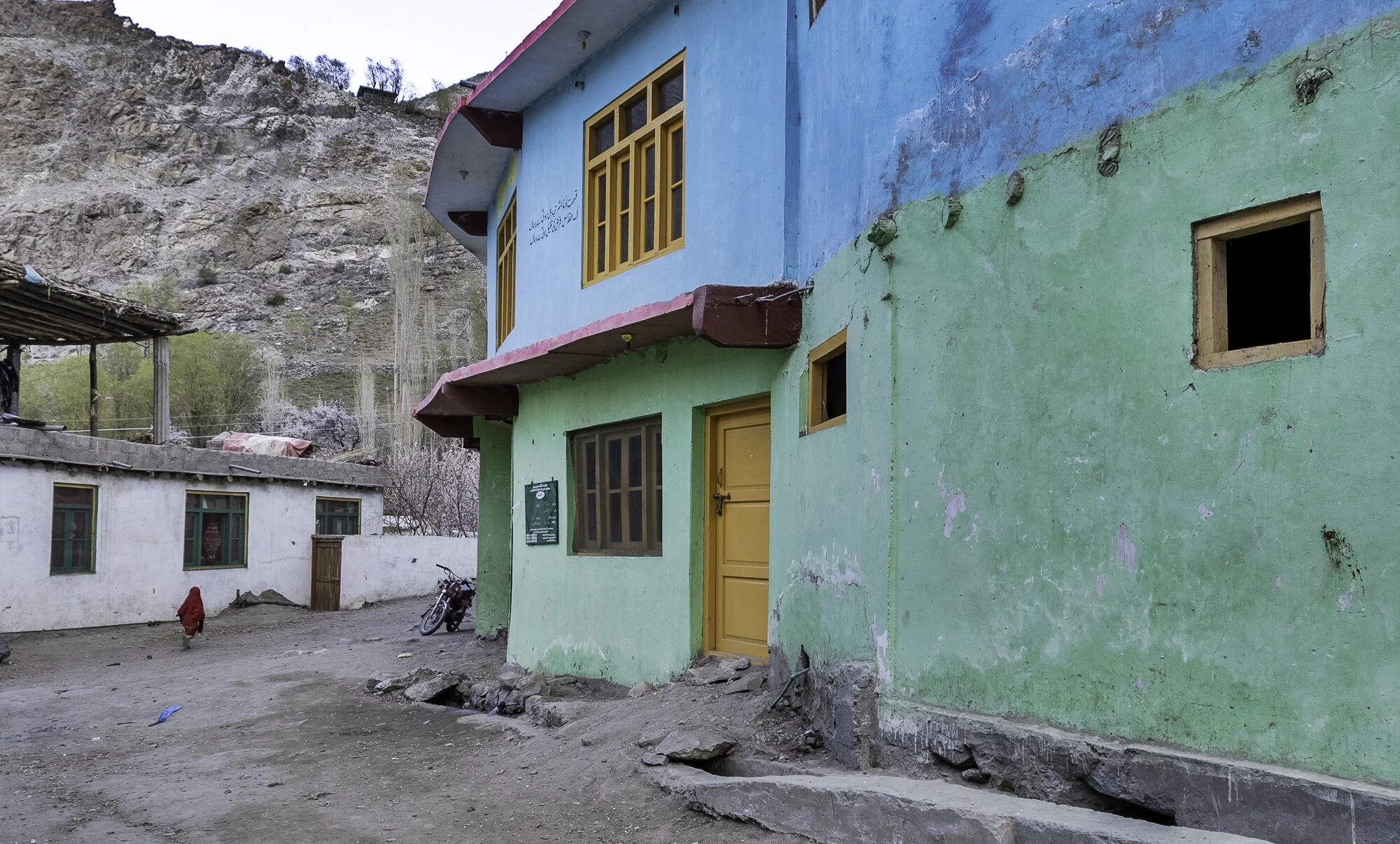
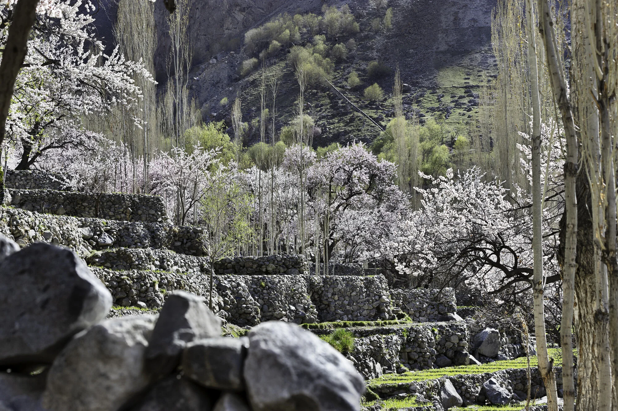
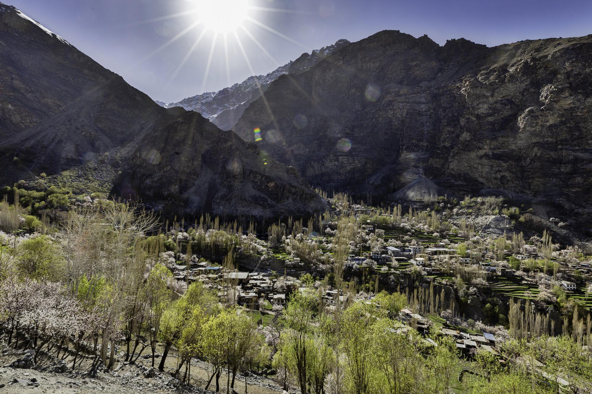
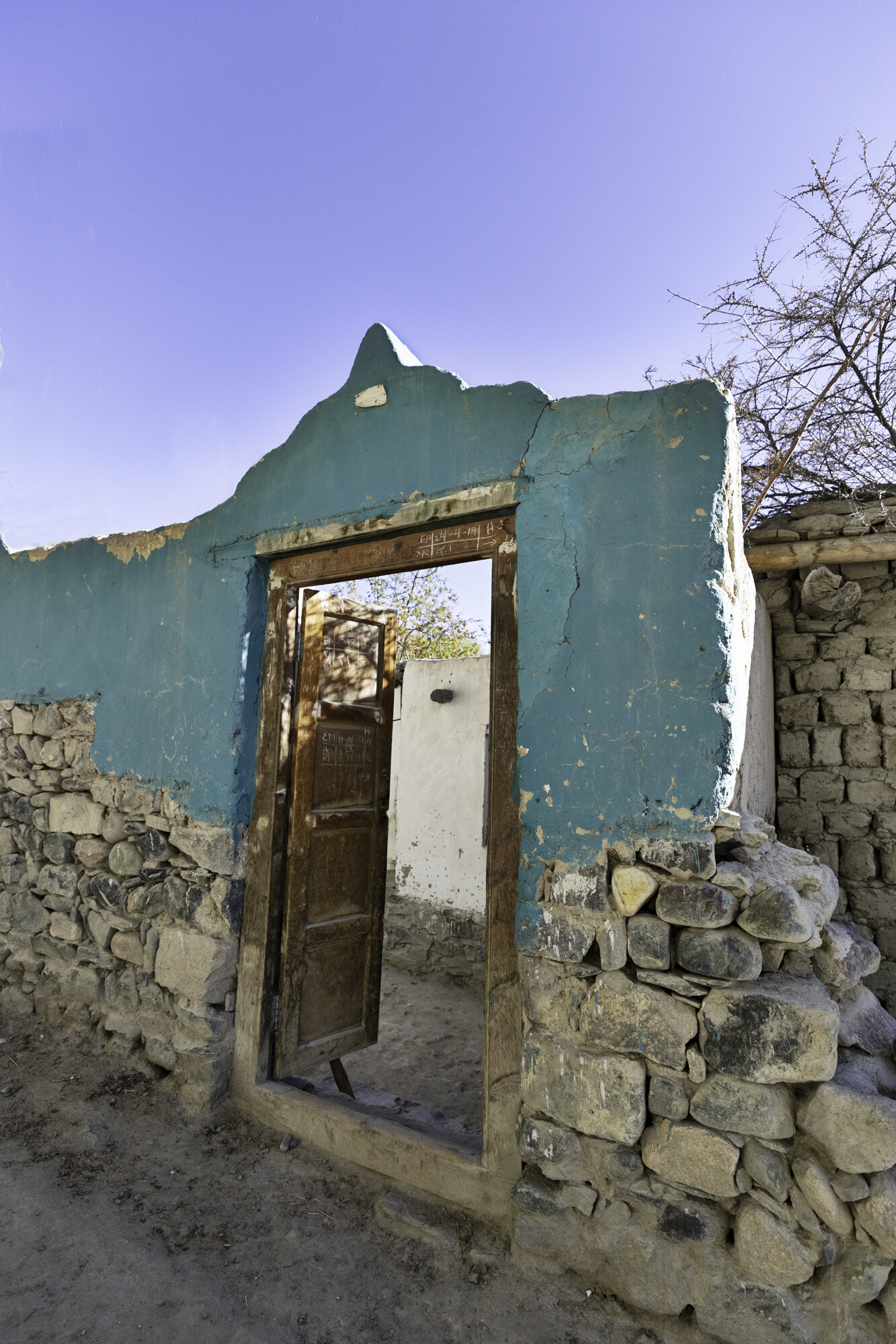
Postcard from Shigar Village - cricket, polo, goats, ducks, horses, washing and water - a wonderful walk

We needed to stretch our legs after a long time sitting in the car and so we decided to take a walk around Shigar Village. The village sits in the beautifully green Shigar Valley, surrounded by mountains with the Shigar River running through the valley. Shigar Village sits at an elevation of 2,230m and is inhabited by the Balti people of Tibetan descent. It is unsure where the name Balti came from however Baltistan is Persian for land of the Baltis.
Our walk took us through the centre of the village, past mosques (the subject of my next blog), shops, colourful houses, women washing, goats grazing and kids playing cricket. I love that wherever we travel in Pakistan we always see children playing cricket and it reminds me of home. We also sat and watched some children playing a version of polo. They ran with polo mallets, expertly hitting a ball across the polo ground. Polo is very popular in Gilgit-Baltistan with every valley seeming to have a polo ground.
Water channels run through the village to direct water to fields and for household use. Women sat and washed clothes or washed dishes. It is a very conservative region and the women didn’t want their photo taken. I did take some lovely photos though of shopkeepers, grandfathers and horse riders who stopped just for me.
I love this colour and you can find it painted on walls and houses


The local barber shop


Washing hung above a stream


Shigar Polo Ground - cricket being played

Practicing polo


Love that he was taking his grandson around the village for a walk


